MOTORCYCLE TRAVEL IN Guatemala
QUICK ANSWER
Guatemala is the mandatory Central American gateway for any motorcycle traveler coming down from Mexico: in a few days of riding you go from the volcano highlands and Lake Atitlán to the Petén jungle and the Caribbean coast of Izabal. Entry is quick if your paperwork is in order — customs (SAT) issues the temporary import permit (TIP) for 90 days at the border crossing itself — though there's currently no nationwide mandatory insurance for the bike: the government decreed one in March 2025 and repealed it days later after strong protests. Your home policy covers nothing here regardless, so it's still worth getting local civil liability coverage.
WHAT YOU NEED TO KNOW
The country you're about to enter has particularities you need to know.
Before you cross the border there are four things you need locked down: how safe the country is, what insurance is mandatory for your motorcycle, where you'll actually find fuel, and when to go. None of these are optional.
SAFETY: MODERATE RISK (3/5)
Is Guatemala safe to enter by motorcycle? Yes on the highland tourist circuit and the main highways, but a handful of specific zones are genuinely off the table.
AREAS TO AVOID
- Zone 18 in Guatemala City and Villa Nueva: Rated Level 4 ('Do Not Travel') by the US State Department, due to gang presence and organized crime. The rest of the capital is not included in the alert.
- Rural San Marcos and Huehuetenango: Also rated Level 4 for cartel and gang crime and terrorism, per the State Department. The La Mesilla border crossing and the Panamericana itself aren't included — the risk is on secondary roads and remote towns within those departments.
- 5 km strip along the Mexico border (Pacific coast): The UK FCDO advises against travel within 5 km of the Mexican border from the Pacific coast, due to sustained gang violence tied to drug-trafficking routes. The official crossings (Tecún Umán, El Carmen) run normally; the risk is in straying off the main route.
- Dirt road between Santiago Atitlán and San Pedro La Laguna: A roughly 3 km unpaved stretch with documented armed robberies against travelers, including motorcyclists — the best-known case, caught on a helmet camera in 2014, made international news. Better to go around the lake via the main road or check with local police before taking it.
WHERE TO PARK
- Parking: On the street: fine by day in busy areas, avoid leaving it overnight. Look for a gated lot or a gas station with cameras, common in Antigua, Xela, and the capital.
- Alarm: Recommended: yes. Especially in Guatemala City; less critical in highland towns like Antigua or around Lake Atitlán.
- Luggage: Take off what you can carry (tank bag, backpack) when parking. Never leave anything loose or visible inside the panniers.
- Visibility: Park where there's foot traffic and good lighting — never on an empty street or near a vacant lot.
TIPS
- ➜Don't ride after dark outside the cities — unmarked potholes, loose livestock, and the lack of lighting all add to the risk of highway robbery.
- ➜At Guatemala City traffic lights, keep valuables out of sight and your hands free to ride off.
- ➜Avoid the Godínez bypass between the capital and Panajachel (it goes through Patzún) — PROATUR's recommended route is the CA-1 to Los Encuentros, then down to Panajachel.
Outside those specific pockets, the highland circuit through Antigua, Lake Atitlán, and Xela, plus the run to Tikal through Petén, ride with the same precautions as anywhere else in the region — the trick is treating the Level-4 zones as genuine no-go areas, not just background statistics.
MANDATORY INSURANCE: Civil liability insurance (RC) — recommended, not legally required
Guatemala does not currently have a nationwide mandatory third-party insurance law: the government decreed one in March 2025 after a bus crash killed 54 people, then repealed it days later under Government Agreements 56 through 59-2025 following protests and road blockades. That means no border official can legally demand proof of insurance to let you in. It's still worth buying local civil liability coverage from a Guatemalan insurer once you're in the country, though — your home-country policy does not cover accidents here, and the legal situation has already flipped once, so it could flip again.
FUEL: GOOD NETWORK, PRICIER UP NORTH
Guatemala has a dense station network along the CA-1 (Panamericana), the road to Tikal, and the routes to Antigua, Atitlán, and Xela — regular gasoline was running around 38 quetzales per gallon (about 5 USD) in late August 2026, per the Energy Ministry's weekly price report. The price climbs the farther you get from the capital: fill up in Guatemala City or Escuintla before heading into Petén, Izabal, or Huehuetenango, where a gallon can cost 1-2 quetzales more. There's no real fuel desert on the main routes — Flores (near Tikal), Río Dulce, and El Rancho are reliable refill points on the road to Petén — but stations thin out fast on unpaved side roads, so plan around the towns, not the map.
BEST SEASON: NOV → APR
November to April is the dry season: clear skies over the volcanoes around Lake Atitlán, roads in better condition, and far less risk of landslides on mountain routes like the one to Semuc Champey. The rest of the year (May to October) rain tends to fall in the afternoon and evening, so mornings still work for riding, but unpaved stretches turn to mud fast. February and March are the driest months; November and April are transition months with lighter, more sporadic rain.
ENTERING GUATEMALA BY MOTORCYCLE
Guatemala has three border crossings most used by motorcycle travelers coming from Mexico — La Mesilla (Ciudad Cuauhtémoc side, the Panamericana route through Huehuetenango toward Lake Atitlán), Tecún Umán (Ciudad Hidalgo side, the Pacific coast route), and El Carmen (Talismán side) — plus El Florido toward Copán Ruinas in Honduras and Melchor de Mencos toward Belize and Tikal. According to Horizons Unlimited's border-crossing notes and traveler accounts on Mad or Nomad, the process at these main posts is straightforward.
The process has two steps:
Immigration: Stamps your passport on entry — that same stamp works for later moving within the CA-4 bloc (El Salvador, Honduras, Nicaragua).
Customs (SAT): Issues the TIP (Temporary Import Permit) for the motorcycle, at the same post, along with tire fumigation.
The TIP is not free in Guatemala, unlike some neighboring countries: the SAT charges around Q160 for the Declaraguate form, Q100 for the tourism sticker, and Q60 for the authorization form — plus roughly Q16 for the mandatory tire fumigation at entry, according to SAT's official portal.
Real friction point:it's not the paperwork itself but the insurance confusion. In March 2025 Guatemala decreed mandatory third-party insurance for every vehicle, including motorcycles — then repealed it days later (Government Agreements 56 through 59-2025) after nationwide protests and road blockades. Some border agents or roadside checkpoints may still cite the old rule as if it were current law; it isn't, but the situation has shifted before and could shift again, so it's worth checking the latest status before you cross.
The second friction point is CA-4 itself: your passport doesn't get re-stamped moving between Guatemala, El Salvador, Honduras, and Nicaragua, but your motorcycle's TIP absolutely does — you need a fresh one at every one of those borders, and the 90-day clock does not reset when you cross into the next CA-4 country.
REQUIRED DOCUMENTATION
Valid passport: Valid for the whole length of your stay.
Driving license: Your home country's license is enough.
Motorcycle title/registration: If you're not the owner, you need notarized power of attorney from them.
Declaraguate form (TIP): The temporary import permit — issued by SAT at the border crossing itself, with copies of your passport, title, and license.
Tire fumigation: Mandatory phytosanitary step at the border crossing, about Q16.
With these five documents sorted, entering Guatemala with a bike is routine, if not free — budget around 320 quetzales (roughly 40 USD) in official fees between the TIP paperwork and the fumigation charge. The advice that comes up most often among motorcycle travelers: keep every stamped copy of your TIP until you've formally cancelled it on exit, because you'll need it to prove the bike left the country — and to cross into the next CA-4 country cleanly.
DAILY BUDGET
This price range combines cheap lodging, cooking your own meals, and basic bike maintenance — the three categories that weigh most on any moto traveler's daily budget.
Your real daily budget is something you build yourself, based on your own needs and limits — but if you want an idea of how to build yours, pick a category to see the full guide:
Full cost breakdown in the budget guide
THE 10 BEST MOTORCYCLE ROUTES IN GUATEMALA
This ranking is ordered by real-world fame, not personal taste: the Lake Atitlán loop tops the list because it's the route that comes up first in practically any international search about motorcycling in Guatemala, the one most ridden by both foreign travelers and local operators, and the one with the most travel accounts, dedicated tours and mentions in motorcycle-travel forums. From there, the order drops based on how much real footprint each route left in specialized blogs, motorcycle tour operators and rider accounts from people who actually rode it.
If you're coming down from Mexico or continuing on toward Honduras and Belize, before heading out on any of these routes it's worth reviewingthe step-by-step guide to crossing a border by motorcycle, so the TIP paperwork at each CA-4 border doesn't eat up a whole day of riding.
Several of these routes climb above 2,500 meters or run through towns where the nearest workshop is two hours away, so it's worth reviewingthe mechanics guide for long motorcycle tripsbefore you leave Antigua or Panajachel.
The Lake Atitlán Loop
SololáThe Lake Atitlán loop by motorcycle is, for almost any rider researching routes in Guatemala, the first one that comes up — operators like Ride Atitlán offer it as their flagship tour out of Panajachel, and international motorcycle-travel blogs describe it outright as some of the best riding in the world for its mix of tight curves, altitude and volcanic scenery.
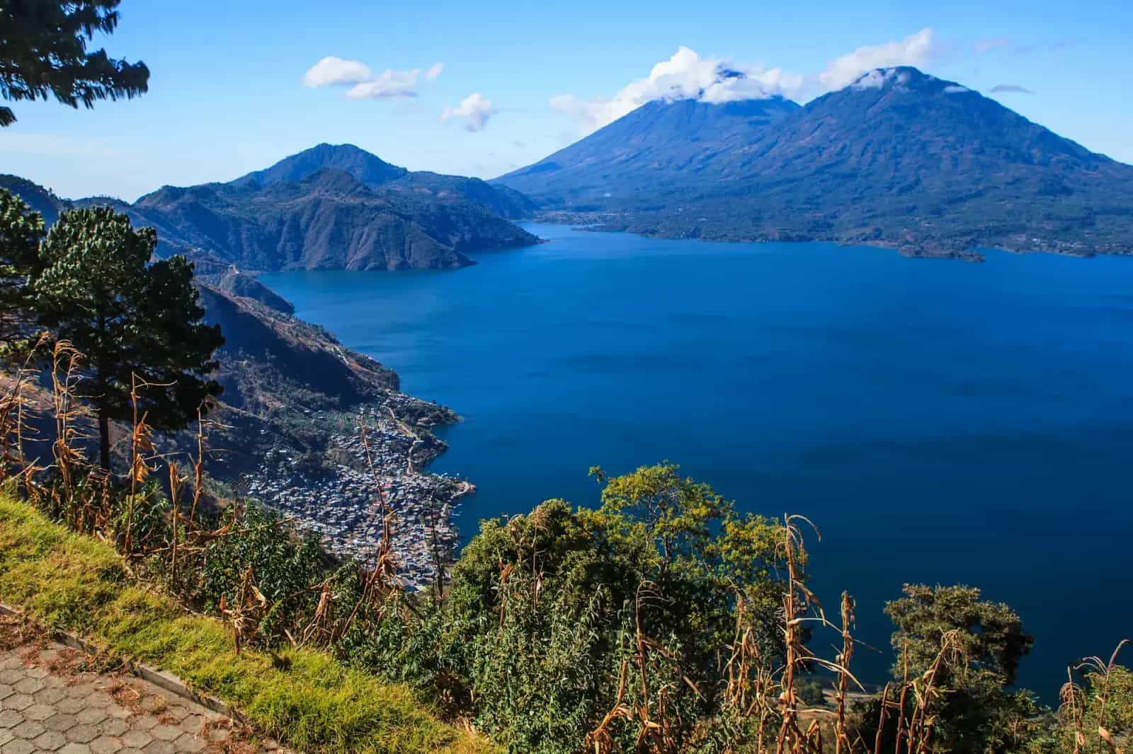
The lake sits in a caldera formed by a supervolcanic eruption around 85,000 years ago, and today it's ringed by three volcanoes — San Pedro, Tolimán and Atitlán — visible from almost any stretch of the route.
The real cult section is between San Antonio Palopó and Agua Escondida: a climb of roughly 600 meters of elevation gain over loose dirt, fine dust and tight hairpin turns, a world away from the curvy pavement that makes up the rest of the loop.
WARNINGS FOR THIS ROUTE
This is what you need to sort out before riding this route.
- 01Fuel range
Good in the main towns — Panajachel, Santiago Atitlán and San Pedro La Laguna all have stations. There's no fuel on the climb from San Antonio Palopó to Agua Escondida: leave with a full tank.
- 02Dirt shortcut toward San Pedro La Laguna
The dirt stretch between Santiago Atitlán and San Pedro La Laguna —a roughly 3km shortcut some riders use to close the loop without going around the whole lake— has documented armed robberies against travelers, including motorcyclists; the best-known case, caught on a helmet camera in 2014, made international news. Close the loop via the main road instead of taking that shortcut.
Semuc Champey and Lanquín
Alta VerapazThe road to Semuc Champey by motorcycle is the route that shows up most often in the accounts of riders crossing all of Guatemala — nearly every published itinerary includes it, from specialized blogs to Adventure Bike Rider magazine, which devoted an entire article to it titled "The Rocky Road to Paradise".
Semuc Champey is a natural limestone bridge roughly 300 meters long over the Cahabón river, with a series of stepped turquoise pools formed by limestone dissolving over thousands of years — the actual river runs underneath, through caves, and only resurfaces past the bridge.
The access from Lanquín is just 10 km, but the last 5 are loose gravel with a very steep, rocky final stretch right before the parking lot — the classic bottleneck that turns a short distance into a long hour of technical riding.
WARNINGS FOR THIS ROUTE
This is what you need to sort out before riding this route.
- 01Fuel range
Good in Cobán and Lanquín; no service on the final gravel stretch to the park.
Acatenango and Fuego:the balcony over the active volcanoes
Chimaltenango / SacatepéquezThe ride up to La Soledad, the base for climbing Acatenango by motorcycle, has become part of the standard itinerary for any motorcycle traveler in Antigua ever since the overnight camp facing Fuego went viral on social media — not because of Acatenango itself, but because from its 3,976 meters you can watch, just a few kilometers away, the Fuego volcano in full activity.
Fuego is one of Central America's most active volcanoes: it produces explosive eruptions almost daily, and in June 2018 it was behind one of the deadliest eruptions in the region's recent history, with a pyroclastic flow that wiped out entire communities on its flanks.
The access road leaves Antigua, crosses Alotenango and ends in a stretch of dirt and loose rock up to La Soledad — from there, the bike stays behind and a multi-hour hike to base camp begins.
WARNINGS FOR THIS ROUTE
This is what you need to sort out before riding this route.
- 01Fuel range
Fair. Last reliable station is in Antigua or Alotenango; nothing at La Soledad.
- 02Active volcanic hazard zone
The June 2018 Fuego eruption left close to 200 confirmed dead and several hundred missing among the communities on its flanks, according to international disaster reports — always respect current access restrictions and never approach Fuego itself, only the viewpoint from Acatenango.
Antigua to Pacaya Volcano
Sacatepéquez / EscuintlaRiding to the base of Pacaya Volcano is, after Lake Atitlán, the second route almost any motorcycle traveler passing through Antigua ends up doing — it's the country's most accessible active volcano, with a short two-hour hike up to 2,500 meters where you can see the fumaroles up close.
The road leaves Antigua toward Escuintla and turns off at San Vicente Pacaya, a farming village on the volcano's flanks where the pavement runs out and a stretch of packed volcanic dirt begins, dark from ash built up over past eruptions.
Unlike Fuego or Acatenango, Pacaya doesn't require an overnight camp: you can ride Antigua to Pacaya Volcano by motorcycle there and back in a single day, which makes it the entry-level volcano for anyone who just arrived in Guatemala.
WARNINGS FOR THIS ROUTE
This is what you need to sort out before riding this route.
- 01Fuel range
Good. San Vicente Pacaya and Antigua both have full-service stations; there's none inside the park.
Petén Jungle:Flores to Tikal
PeténRiding to Tikal through the Petén jungle is covering the last leg of the trip almost every motorcycle traveler heading down from Mexico sets as a final destination before turning toward Belize or the rest of Central America — it's by far the country's most visited and most searched-for archaeological site.
Tikal was one of the most powerful cities in the Maya world, with documented activity from the 1st century and its peak between 200 and 800 AD — its temples rise over 60 meters and still poke above the jungle canopy, among giant ceiba trees where howler and spider monkeys swing.
The road from Flores is mostly smooth pavement all the way to El Remate, and gets a little rougher near the park entrance, where the jungle closes in on both sides of the road and the humid heat is felt even while riding.
WARNINGS FOR THIS ROUTE
This is what you need to sort out before riding this route.
- 01Fuel range
Good. Stations in Flores, Santa Elena and El Remate; nothing inside the park.
The Cuchumatanes:Huehuetenango to Todos Santos Cuchumatán
HuehuetenangoRiding up to Todos Santos Cuchumatán by motorcycle means climbing into the Sierra de los Cuchumatanes, the highest non-volcanic mountain range in all of Central America — its highest peak, La Torre, reaches 3,837 meters above sea level, only slightly below the country's tallest volcanoes.
Unlike the volcanic routes out of Antigua, there's no crater or perfect cone here: the landscape is cold páramo, sparse pine forest and high-altitude grassland, with Todos Santos standing out as one of the Maya-Mam towns that best preserved its traditional dress across the entire western highlands.
The road from Huehuetenango climbs through tight curves over the first paved kilometers and opens into stretches of loose gravel as it gains altitude — fog can drop suddenly, even on a day that started completely clear.
WARNINGS FOR THIS ROUTE
This is what you need to sort out before riding this route.
- 01Fuel range
Fair. Last reliable station is in Huehuetenango; supply in Todos Santos is limited and irregular.
Chichicastenango and the Highland Panamericana
Sololá / QuichéThe stretch of the Panamericana between Panajachel and Chichicastenango by motorcycle is one of the most-ridden sections of the highlands — tight curves through pine forest and cornfields, with Los Encuentros as the junction where you decide whether to continue toward Xela or drop down to Chichi.
Chichicastenango has the largest open-air market in all of Central America, running every Thursday and Sunday since before the Spanish conquest — on the steps of the Santo Tomás church, built in the 16th century over a pre-Hispanic temple, Maya ceremonies still mix with Catholic rites.
It's a short, fully paved stretch, but it works as the mandatory gateway to more demanding highland routes — Santa Cruz del Quiché, the Ixil Triangle and Huehuetenango all branch off from this same junction.
WARNINGS FOR THIS ROUTE
This is what you need to sort out before riding this route.
- 01Fuel range
Excellent. It's the Panamericana — stations are frequent along the whole way.
The Ixil Triangle:Sacapulas to Nebaj
QuichéThe road to the Ixil Triangle by motorcycle climbs north from Sacapulas, already inside the Sierra de los Cuchumatanes, up to Nebaj — the largest of the three Ixil towns, along with Chajul and Cotzal, which form an almost perfect triangle on the map of Quiché.
Nebaj sits at 1,907 meters, ringed by cloud-forested mountains, and remains one of the country's most isolated Maya regions — travel times are long and unpredictable, and the Ixil language is spoken daily on the street.
It's one of the highland areas where traditional women's dress, with its intensely colored embroidery, survives most strongly — riding in still feels like stepping off the country's standard tourist circuit.
WARNINGS FOR THIS ROUTE
This is what you need to sort out before riding this route.
- 01Fuel range
Limited. Last reliable station is in Sacapulas; Nebaj has supply but it's irregular.
Fuentes Georginas:the Zunil hot-spring road
QuetzaltenangoThe road to Fuentes Georginas by motorcycle is narrow, climbs in tight curves out of Zunil and barely leaves room to pass an oncoming vehicle — a short but demanding route that climbs into cloud forest above 2,200 meters.
On the way up, with a bit of luck and clear sky, you get a close view of Santa María volcano, one of the country's tallest, before the midday fog rolls in and blocks the view most days.
The hot springs themselves are of volcanic origin, with natural hot-water pools set among rock walls and dense vegetation — the perfect payoff after a stretch of cold, technical riding.
WARNINGS FOR THIS ROUTE
This is what you need to sort out before riding this route.
- 01Fuel range
Good. Full-service stations in Xela and Zunil; nothing further up on the way to the springs.
Río Dulce and the Castillo de San Felipe
IzabalThe CA-9 toward Río Dulce by motorcycle is the route that connects the volcanic highlands with the Guatemalan Caribbean, gradually dropping from the capital down into the humid heat of Izabal, where Lake Izabal empties out toward the sea.
There, at the mouth of the river, stands the Castillo de San Felipe de Lara, a 17th-century Spanish fortress built to stop constant English pirate attacks on the Caribbean — it carries nineteen cannons and was burned to the ground by pirates in 1686 before being rebuilt.
It's the flattest, fastest route on this list, but also the gateway to the tropical, Caribbean side of a country most motorcycle travelers only know for its volcanoes and highlands.
WARNINGS FOR THIS ROUTE
This is what you need to sort out before riding this route.
- 01Fuel range
Excellent. Frequent stations in El Rancho, Morales and all along the CA-9.
NEIGHBORING COUNTRIES
Crossing the border next? Click a country to see its 10 best motorcycle routes.


FREQUENTLY ASKED QUESTIONS
01What is the TIP and how much does it cost to bring my motorcycle into Guatemala?
+
What is the TIP and how much does it cost to bring my motorcycle into Guatemala?
It's the Temporary Import Permit issued by SAT (Guatemalan customs) right at the border crossing. According to SAT's official portal, the process includes the Declaraguate form (Q160), a tourism sticker (Q100), and the authorization form (Q60) — it's not free, unlike some other countries in the region. It's granted for 90 days and can be extended.
02Do I need mandatory insurance to bring my motorcycle into Guatemala?
+
Do I need mandatory insurance to bring my motorcycle into Guatemala?
No, not currently. The government decreed mandatory third-party insurance for all vehicles in March 2025, then repealed it days later (Government Agreements 56 through 59-2025) after strong protests and road blockades. Don't buy a policy at the border if you're told it's legally required without confirming it — but it's still worth getting local coverage anyway, since your home insurance covers nothing inside Guatemala.
03What is CA-4 and how does it affect my motorcycle if I continue into Honduras or El Salvador?
+
What is CA-4 and how does it affect my motorcycle if I continue into Honduras or El Salvador?
CA-4 is the agreement between Guatemala, El Salvador, Honduras, and Nicaragua that lets you move between those four countries without a new passport stamp, as if it were a single territory for visitors. It doesn't work the same way for the bike, though: the TIP is processed country by country, so you need a new permit at each CA-4 border, and you should carry a copy of your cancelled Guatemalan TIP when you head into the next country.
04Is it safe to ride into Guatemala City on a motorcycle?
+
Is it safe to ride into Guatemala City on a motorcycle?
With precautions, yes, except for Zone 18 and the municipality of Villa Nueva, which the US State Department keeps at Level 4 ('Do Not Travel') due to gang presence and organized crime. The rest of the capital and tourist zones like Zona 1, Zona 10, or Zona 4 are manageable with the same precautions as any large Central American city — avoid riding at night and don't linger at traffic lights with gear in plain sight.
05What's the best time of year to ride through Guatemala?
+
What's the best time of year to ride through Guatemala?
November to April, the dry season: clear skies to see the volcanoes from Lake Atitlán, roads in better shape, and less landslide risk on mountain stretches. Outside that window (May to October) rain tends to concentrate in the afternoons, so morning riding still works, but dirt roads toward places like Semuc Champey get rougher.
06How much does it cost to travel by motorcycle through Guatemala per day?
+
How much does it cost to travel by motorcycle through Guatemala per day?
Between 25 and 50 USD a day covers a hostel, local food, and fuel, based on traveler budget guides for the country — one of the most affordable in Central America. Camping cuts accommodation cost to a couple of dollars in the few places it exists (El Remate, Lanquín), and the range rises if you prefer a mid-range hotel every night.
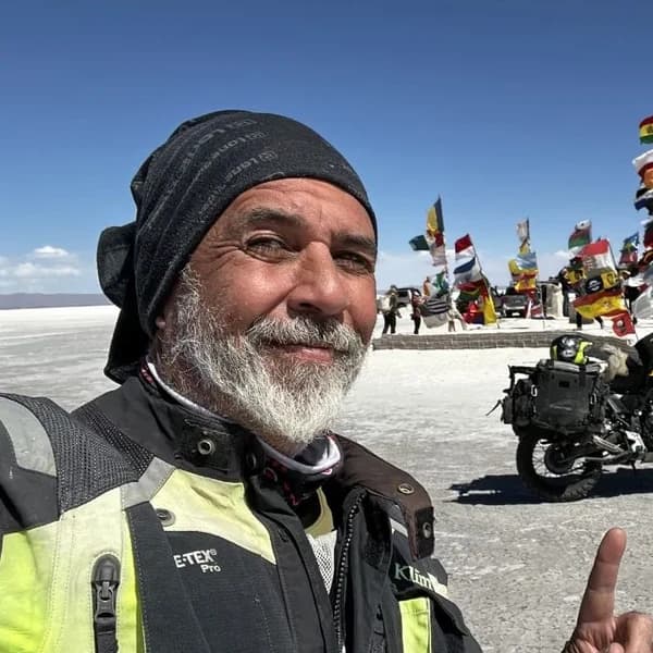
Gustavo Correa
Moto traveler, author and motorcycle travel consultant. 110,000+ km across 4 continents with Gloria, my motorcycle. Everything you read here has been tested on the road, not in an office.
Read my story →Last verified: 2026-08-29
Sources consulted (24)+
- madornomad.com
- portal.sat.gob.gt
- livinginguatemala.com
- swissinfo.ch
- swissinfo.ch
- lahora.gt
- ticotimes.net
- gt.usembassy.gov
- gov.uk
- horizonsunlimited.com
- horizonsunlimited.com
- huffpost.com
- infobae.com
- livinginguatemala.com
- neverendingfootsteps.com
- nomad-as.com
- motosfreedom.com.gt
- elcaminomascorto.com
- elcaminomascorto.com
- guatemala.com
- en.wikipedia.org
- felixpago.com
- commons.wikimedia.org
- livinginguatemala.com
A GIFT FOR BEING HERETHE ADVENTURE OF LIVING FREE
Do fear or doubt paralyze you before starting any project? You're not alone — every one of us has been there.
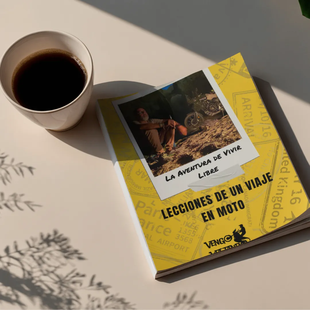
As a thank-you for visiting my site, I'm giving you my book "The Adventure of Living Free". A manual built to bring some light through the shadows and show you the philosophy that has let me ride the world for years.
* PDF STRAIGHT TO YOUR INBOX. NO SPAM.