MOTORCYCLE TRAVEL IN Namibia
QUICK ANSWER
Namibia is one of Africa's most sought-after motorcycle destinations: almost the entire road network outside the main highways is well-maintained gravel or sand, running through landscapes like the Namib Desert, Sossusvlei, and the Skeleton Coast. Entering through a land border (from South Africa, for example) is straightforward: there's no insurance to buy at the crossing, but you do pay the Cross-Border Charge for foreign vehicles and, without a Carnet de Passage, you'll only get a 14-day temporary import permit.
WHAT YOU NEED TO KNOW
The country you're about to enter has particularities you need to know.
Before you cross the border there are four things you need locked down: how safe the country is, what insurance is mandatory for your motorcycle, where you'll actually find fuel, and when to go. None of these are optional.
SAFETY: LOW RISK (2/5)
Is Namibia safe to enter by motorcycle? Yes — it's one of the calmest countries in sub-Saharan Africa to travel through by motorcycle, although urban crime in Windhoek has been rising.
AREAS TO AVOID
- Katutura and informal settlements (Windhoek): The US State Department notes that violent crime —robberies, assaults, home invasions— has been rising in Windhoek, with Katutura and other informal settlements accounting for a large share of reported incidents. Avoid entering after dark; by day, stick to the main streets.
- Downtown Windhoek at night: "Smash and grab" robberies targeting vehicles stopped at intersections, near tourist areas, or in shopping mall parking lots — a common crime pattern across Southern Africa. Avoid riding or parking there after dark.
WHERE TO PARK
- Parking: At campsites and lodges, no issue. In Windhoek and Swakopmund, prefer a guarded mall parking lot over the street, especially at night.
- Alarm: Worth having in Windhoek and the coastal towns. Not much of a priority inland or on the gravel routes, where there's barely any traffic.
- Luggage: Take off what you can carry (tank bag, backpack) when parking in a city. Never leave anything loose in plain sight.
- Visibility: Park where there's foot traffic and good lighting — never in an alley or a dark corner downtown.
TIPS
- ➜Avoid entering Katutura or downtown Windhoek at night if you can plan around it.
- ➜Don't leave the bike sitting at a light for long with bags in plain sight — "smash and grab" robberies target exactly that.
- ➜Watch for animals crossing the road at dawn and dusk, especially springbok — it's a real accident risk, not just inside parks.
Outside those specific Windhoek spots, Namibia is one of the calmest countries in Africa to travel through by motorcycle — the police have a reputation for honesty and violent crime against travelers on the road is rare.
MANDATORY INSURANCE: Cross-Border Charge (CBC) — MVA Fund
There's no insurance you buy on the spot when crossing, unlike other countries. Every foreign-plated motorcycle pays the Cross-Border Charge at the RFA office right at the border post, around R188, which funds the MVA Fund: no-fault traffic accident cover that automatically applies to anyone riding in the country, foreigners included. It doesn't cover third-party property damage or theft of the bike — that's down to your own international policy if you carry one.
FUEL: SCARCE IN THE NORTH
Good availability along the paved B1 and B2 highways and in every coastal town (Swakopmund, Walvis Bay). In remote areas —Kaokoland, the Skeleton Coast Park, stretches of the Caprivi— distances without a station can run past 200-300 km. Carry a spare can if your tank is small and you're off the main routes.
BEST SEASON: MAY → SEP
May through September/October, the dry southern-winter season: 20-25°C (68-77°F) by day, cold nights, and the gravel routes in their best condition. The rainy season (November to April) can make whole stretches impassable, especially in the north.
ENTERING NAMIBIA BY MOTORCYCLE
Crossing into Namibia with a bike through a land border —Ariamsvlei/Nakop, Noordoewer/Vioolsdrift, or Trans Kalahari/Buitepos from South Africa and Botswana are the ones overlanders use most, according to accounts on Horizons Unlimited and Mad or Nomad— is one of the simplest procedures in Southern Africa, with no long queues or documented bribe requests.
The process has two steps:
Immigration: Stamps your passport on entry; most nationalities get a free 90-day residence permit.
Customs / RFA: Issues the Temporary Import Permit (TIP) for the motorcycle and collects the Cross-Border Charge at the Road Fund Administration office right at the post.
The Temporary Import Permit (TIP) that clears your bike at the border is free — according to Namibia's Road Fund Administration.
Real friction point:unlike countries such as Chile, Namibia doesn't require buying insurance at the crossing. What every foreign-plated motorcycle does pay is the Cross-Border Charge (CBC) at the RFA office right at the post —around R188 for motorcycles— which funds the MVA Fund, the no-fault traffic accident cover that automatically applies to anyone riding in the country.
The other real point is the Carnet de Passage: it's not mandatory if you enter through a land border, but without one you only get a 14-day temporary import permit, extendable to 28 at an inland customs office. Anyone planning to stay longer or continue overland through the rest of Africa should arrange it beforehand, through their home country's automobile association.
REQUIRED DOCUMENTATION
Valid passport: Valid for the whole length of your stay; most nationalities get 90 days free on arrival.
Driving license: Your home country's license is usually enough; an International Driving Permit (IDP) is a good backup.
Motorcycle title/registration: If you're not the owner, you need notarized power of attorney from them.
Carnet de Passage en Douane (CPD): Not mandatory at land crossings, but strongly recommended — without it you only get a 14-day permit.
Cross-Border Charge (CBC) receipt: Paid right at the border, at the RFA office — around R188 for motorcycles.
Yellow fever certificate: Mandatory if you're arriving from, or have transited, a risk country — common if you've crossed the rest of Africa first.
With these six documents sorted, entering Namibia with a bike through a land crossing is routine. The advice that comes up most often among motorcycle travelers: if you're continuing through the rest of Africa or staying longer than 28 days, arrange the Carnet de Passage before you leave home — sorting it out mid-trip is far more complicated.
DAILY BUDGET
This price range combines cheap lodging, cooking your own meals, and basic bike maintenance — the three categories that weigh most on any moto traveler's daily budget.
Your real daily budget is something you build yourself, based on your own needs and limits — but if you want an idea of how to build yours, pick a category to see the full guide:
Full cost breakdown in the budget guide
THE 10 BEST MOTORCYCLE ROUTES IN NAMIBIA
Namibia has a worldwide reputation as one of the best countries on the planet for gravel-road motorcycle travel: a well-maintained network of C and D roads, almost no traffic, and landscapes that shift from desert to canyon to coast in a single day. The order of this Top 10 isn't random: it opens with the postcards and routes any international rider finds first when researching "motorcycle route Namibia" —the most photographed, ridden and recommended— and works down toward routes that are just as real but more niche, sought mainly by riders who already have experience on sand and technical gravel.
Before heading out for hundreds of kilometers of Namibian gravel with no signal or fuel station in sight, it's worth reviewinghow to prepare for a long motorcycle trip, because here preparation matters more than in any other country on this list.
And since on several of these routes the nearest repair shop can be a full day away, it's worth reviewingthe mechanics guide for long motorcycle tripsbefore heading into Kaokoland or the Skeleton Coast.
Sesriem and Sossusvlei:the Red Dunes of the Namib
Hardap Region (Namib-Naukluft)Riding to Sesriem and Sossusvlei by motorcycle means heading toward Namibia's single most photographed postcard: sand dunes rising over 300 meters above the Namib, the world's oldest desert.
Dune 45, the one most climbed by tourists, is built from sand roughly 5 million years old and rises 80 meters above the plain. A little further west, Big Daddy climbs to around 325 meters.
The final payoff is Deadvlei, a white clay pan where the skeletons of camelthorn trees are still standing 550 years after they died — the Namib's extreme climate mummified them instead of letting them rot.
From Sesriem, the last kilometers to the pan leave the pavement behind: you cross deep loose sand, the one genuinely technical stretch of the whole day.
WARNINGS FOR THIS ROUTE
This is what you need to sort out before riding this route.
- 01Fuel range
Good, but limited on the final stretch. There are stations in Solitaire and Sesriem; nothing in between.
The Skeleton Coast:C34 Route
Erongo and Kunene coast (Skeleton Coast Park)Riding the Skeleton Coast by motorcycle means covering roughly 500 km of Atlantic coastline where the cold Benguela current generates dense fog nearly every day of the year — the same fog that sank dozens of ships against the shore.
Among the best-known wrecks are the Eduard Bohlen, run aground in the early 20th century and now stranded hundreds of meters inland as the sand advanced, and the Dunedin Star, whose 1942 wreck inspired the book that gave the region its name.
The San people called it "the land God made in anger"; Portuguese sailors called it "the gates of hell." On a bike, the landscape feels even more literal: gravel and packed salt between dunes and ocean, with nothing else on the horizon.
It's one of the most famous gravel routes on the planet among motorcycle travelers — not for its technical difficulty, but for the near-total emptiness and a fog that can change visibility from one kilometer to the next.
WARNINGS FOR THIS ROUTE
This is what you need to sort out before riding this route.
- 01Fuel range
Critical. The last reliable station before entering the park is Henties Bay; inside Skeleton Coast Park, fuel is scarce and seasonal (Torra Bay only opens during the December–January fishing season).
- 02Fog that cuts visibility without warning
The cold Benguela current produces dense fog nearly every day of the year on this stretch — the same fog that sank the ships that gave the coast its name. It can cut visibility to a few meters with almost no warning.
Spreetshoogte Pass:Namibia's Steepest Descent
Hardap Region, between Rehoboth and SolitaireDescending Spreetshoogte Pass by motorcycle means tackling Namibia's steepest grade: between 1:4.5 and 1:6, with tight switchbacks dropping nearly 1,000 meters in just 4 km of road, from 1,822 masl on the Great Escarpment down to the Namib plain.
It was built by hand during World War II by farmer Nicolaas Spreeth, who dynamited quartzite to open a route connecting his farm to a delivery point at the top. It turned out so steep that heavy traffic and many cautious travelers simply detour via the neighboring Remhoogte Pass instead, about 30 km longer but without Spreetshoogte's extreme grade.
It's the most-cited viewpoint on the road between Windhoek and Solitaire: from the rest stop halfway down the slope, the entire Namib unfolds below with nothing in the way.
WARNINGS FOR THIS ROUTE
This is what you need to sort out before riding this route.
- 01Fuel range
Fair. There are stations in Rehoboth to the south and Solitaire to the north; nothing in between on the pass.
Spitzkoppe:the Matterhorn of Africa
Erongo Region, near UsakosRiding around Spitzkoppe by motorcycle means approaching the "Matterhorn of Africa": a granite massif rising 670 meters above the Namib plain, with rock over 120 million years old.
Its walls hold rock paintings between 2,000 and 4,000 years old, left by the San. The first documented ascent of the summit was only achieved in November 1946, by a team out of Cape Town.
Stanley Kubrick used it as the backdrop for the dawn-of-man sequences in 2001: A Space Odyssey — no coincidence: few places on Earth look this detached from the planet itself.
You reach it via gravel roads from Usakos, with the peak appearing alone, with nothing around it, long before you reach its base.
WARNINGS FOR THIS ROUTE
This is what you need to sort out before riding this route.
- 01Fuel range
Good. There's a station in Usakos, a short gravel stretch from the massif.
Fish River Canyon:the Great Southern Loop
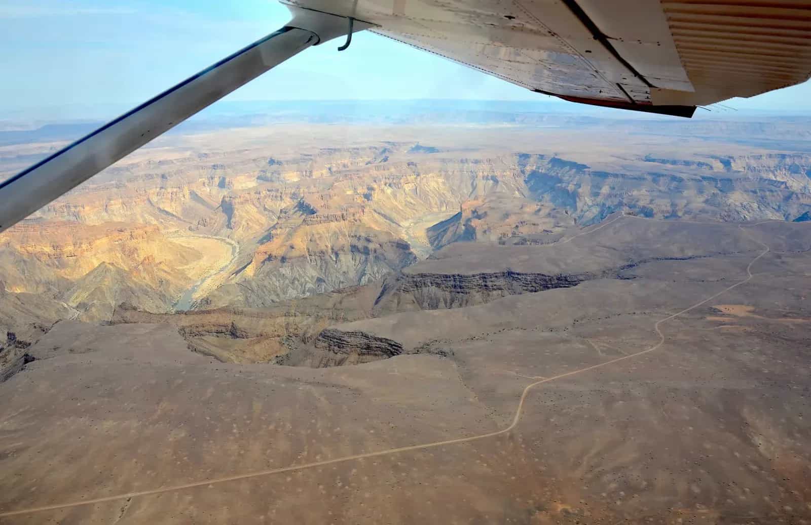
ǁKaras Region, southern NamibiaSkirting the Fish River Canyon by motorcycle means riding the rim of Africa's largest canyon: 160 km long, up to 27 km wide, and nearly 550 meters deep at its lowest point.
It formed about 650 million years ago as a tectonic graben, and a glacier from the Karoo Ice Age deepened it roughly 300 million years ago — what you see today from the viewpoint is hundreds of millions of years of geology exposed in a single glance.
It's Namibia's second most-visited tourist attraction, declared a national monument in 1962. In summer the park itself closes the hiking trail because of extreme heat, up to 48°C by day — the same reason it's worth avoiding the route on a bike during those months.
WARNINGS FOR THIS ROUTE
This is what you need to sort out before riding this route.
- 01Fuel range
Limited. There are stations in Grünau and Ai-Ais; the rest of the loop has no fuel, and distances between towns are long.
Damaraland and Twyfelfontein:Ancient Rock Art
Kunene Region (Damaraland)Riding across Damaraland to Twyfelfontein by motorcycle means entering Namibia's first World Heritage Site, declared by UNESCO in 2007: over 5,000 rock engravings spread across 15 sites, dating between 1,000 and 6,000 years old.
Among the figures, the "Lion Man" stands out as one of the most studied images in African rock art. It's an unusual site because it combines engravings and paintings in the same place, something rare on the continent.
The gravel road strings together other cult stops in the region: the Organ Pipes (dolerite columns), Burnt Mountain and the Petrified Forest, all along the same gravel axis that crosses Damaraland east to west.
WARNINGS FOR THIS ROUTE
This is what you need to sort out before riding this route.
- 01Fuel range
Fair. There's a station in Khorixas; there's no fuel within the gravel circuit toward Twyfelfontein.
Kaokoland:Van Zyl's Pass and the Marienfluss Valley
Kunene Region (Kaokoland)Crossing Kaokoland by motorcycle, with Van Zyl's Pass as its toughest point, means entering Namibia's least tamed region: an arid, mountainous strip between the Hoanib River and the Kunene River, the border with Angola, with the Baynes Mountains rising to 2,039 meters.
Local travel guides describe Kaokoland as a territory of "many scenic routes and daring passages, some only barely passable even in a 4x4" — Van Zyl's Pass is the most cited of all among off-road travelers.
On the other side waits the Marienfluss Valley, with its curious grass "fairy circles" and the Kunene River, home to territorial crocodiles and hippos — not a place to get close for a swim.
Along with the Skeleton Coast, it's the route that shows up most often in the trip reports of adventure riders who've already crossed Namibia end to end, even though few actually dare to complete it on two wheels.
WARNINGS FOR THIS ROUTE
This is what you need to sort out before riding this route.
- 01Fuel range
Critical. Fuel is only available in Opuwo; once inside Kaokoland, heading toward Van Zyl's Pass and Marienfluss, there are no stations or rescue signal for hundreds of kilometers. Carry extra jerry cans.
The Caprivi Strip:the Green Corridor to the Zambezi
Zambezi Region (Caprivi Strip)Crossing the Caprivi Strip by motorcycle means riding through Namibia's oddest piece of geopolitics: Germany acquired this strip in 1890 in exchange for giving up Zanzibar and keeping the island of Heligoland, all to reach the Zambezi River and, from there, the Indian Ocean.
The plan never worked: just 65 km downstream sits Victoria Falls, and beyond it the Kariba Gorge closed off any chance of navigating to the sea. The strip, named after Chancellor Leo von Caprivi, ended up a narrow corridor between 32 and 105 km wide.
Today that same shape turns it into a wildlife corridor: elephants migrating between Botswana, Zambia and Angola, and habitat for the African wild dog, one of the continent's most endangered species, spread across the Bwabwata, Mudumu and Nkasa Rupara parks.
On a bike, it's the paved stretch connecting Namibia's desert to a green, river-fed Africa — the shift in scenery is so abrupt it feels like crossing into another country without a single border post.
WARNINGS FOR THIS ROUTE
This is what you need to sort out before riding this route.
- 01Fuel range
Good. Stations in Kongola, Divundu and Katima Mulilo along the whole strip.
From Aus to Lüderitz:Wild Horses and the Ghost Town of Kolmanskop
ǁKaras Region, between Aus and LüderitzRiding from Aus to Lüderitz by motorcycle to see Kolmanskop means heading toward one of the most photographed ghost towns in the world: a German diamond-mining town that, at its peak, had a hospital, a ballroom, a power station, an ice factory and Africa's first tram.
It all began in 1908, when railway worker Zacharias Lewala found a diamond in the sand and geologist August Stauch confirmed the discovery. The German colonial government declared the area a "Sperrgebiet" (forbidden zone), and the diamond rush built Kolmanskop out of nothing.
World War I and the 1928 discovery of richer deposits 270 km south near the Orange River drained the town until its final abandonment in 1956. Today managed by Namdeb (a partnership between the Namibian state and De Beers), its Edwardian-style houses are still there, desert sand pouring through the windows knee-deep.
The 125 km of pavement between Aus and Lüderitz run with the Namib's sea of dunes on one side and the cold Atlantic on the other.
WARNINGS FOR THIS ROUTE
This is what you need to sort out before riding this route.
- 01Fuel range
Good. There are stations in Aus and Lüderitz; the stretch is short and doesn't require an extra jerry can.
The Waterberg Plateau
Otjozondjupa Region, near OtjiwarongoClimbing up to the Waterberg Plateau by motorcycle means riding 68 km southeast of Otjiwarongo to a rock tableland rising above the Kalahari, with a base rock stratum over 850 million years old and dinosaur tracks roughly 200 million years old.
It's also a place loaded with recent history: at the foot of the plateau, the 1904 Battle of Waterberg was fought, the decisive clash between the Herero people and German colonial troops, one of the most tragic episodes in Namibian history. German soldiers' graves still stand at the Bernabe De La Bat rest camp.
Since 1989 the plateau has received black rhinos reintroduced from Damaraland, part of a program that, since the 1970s, turned Waterberg into a refuge for endangered species used to restock other parks around the country.
It's the shortest, most accessible route on this Top 10 — a good first or last day of a Namibian motorcycle trip, with a plateau's elevation change breaking up the endless flatness of the rest of the country.
WARNINGS FOR THIS ROUTE
This is what you need to sort out before riding this route.
- 01Fuel range
Excellent. Full-service station in Otjiwarongo, just 68 km from the plateau access.
NEIGHBORING COUNTRIES
Crossing the border next? Click a country to see its 10 best motorcycle routes.
FREQUENTLY ASKED QUESTIONS
01Do I need a Carnet de Passage to enter Namibia by motorcycle?
+
Do I need a Carnet de Passage to enter Namibia by motorcycle?
It's not mandatory if you enter through a land border, for example from South Africa. Without one, customs issues a 14-day temporary import permit, extendable to 28 at an inland customs office. If you're staying longer or continuing through the rest of Africa, it's worth arranging beforehand from your home country.
02Does Namibia require buying insurance at the border?
+
Does Namibia require buying insurance at the border?
There's no insurance you buy on the spot when crossing, unlike countries such as Chile. What you do pay is the Cross-Border Charge, which funds the MVA Fund —no-fault traffic accident cover— automatically applied to anyone riding in the country.
03How much does the Cross-Border Charge cost for a motorcycle?
+
How much does the Cross-Border Charge cost for a motorcycle?
Around R188 (South African rand, on par with the Namibian dollar) per foreign-plated motorcycle, according to the fee table published by the Road Fund Administration. It's paid in cash right at the RFA office at the border post.
04Is it safe to travel by motorcycle through Namibia?
+
Is it safe to travel by motorcycle through Namibia?
Yes, generally — it's one of the calmest countries in sub-Saharan Africa and the police have a reputation for honesty. The thing to watch is urban crime in Windhoek: "smash and grab" robberies at intersections and near tourist areas, with more incidents concentrated in Katutura and downtown at night. Outside of that, violent crime against motorcyclists passing through is rare.
05What's the best season to ride through Namibia?
+
What's the best season to ride through Namibia?
May through September/October, the dry southern-winter season: pleasant daytime temperatures, cold nights, and the gravel routes in their best condition. The rainy season (November to April) can make whole stretches impassable, especially in the north.
06Do I need a yellow fever certificate to enter Namibia?
+
Do I need a yellow fever certificate to enter Namibia?
It's mandatory if you're arriving from, or have transited, a country considered at risk for yellow fever — common if you cross the rest of Africa first. If you're coming straight from South America without stops in risk countries, it's still worth carrying it in case it's asked for.
07Are there gas stations across all of Namibia?
+
Are there gas stations across all of Namibia?
Not continuously. Along the main paved routes (B1, B2) and in coastal towns availability is good, but in remote areas like Kaokoland or the Skeleton Coast, stretches without a station can run past 200-300 km — carry a spare can.
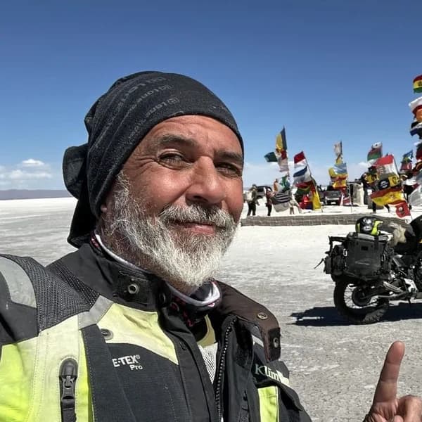
Gustavo Correa
Moto traveler, author and motorcycle travel consultant. 110,000+ km across 4 continents with Gloria, my motorcycle. Everything you read here has been tested on the road, not in an office.
Read my story →Last verified: 2026-08-29
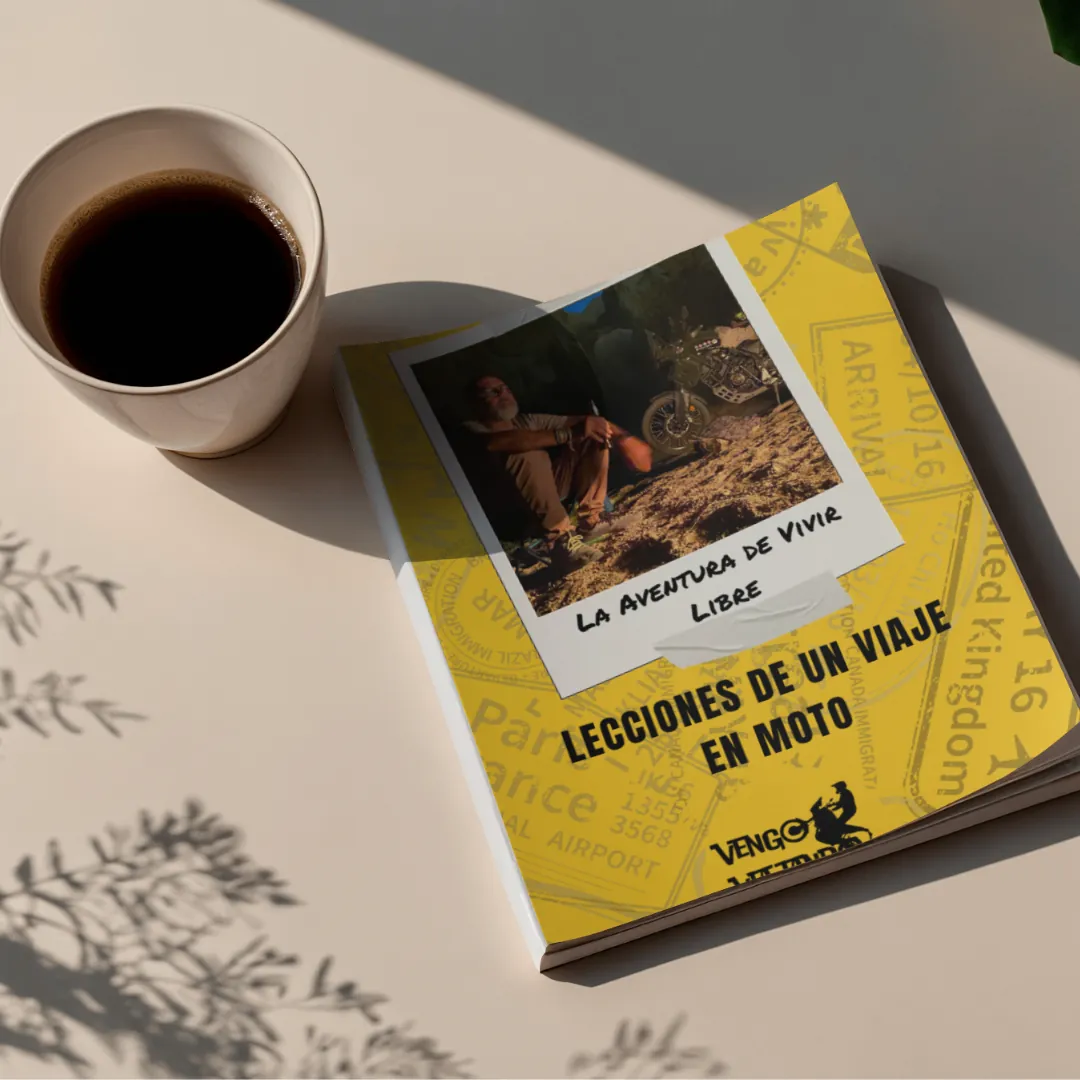
A GIFT FOR BEING HERETHE ADVENTURE OF LIVING FREE
Do fear or doubt paralyze you before starting any project? You're not alone — every one of us has been there.
As a thank-you for visiting my site, I'm giving you my book "The Adventure of Living Free". A manual built to bring some light through the shadows and show you the philosophy that has let me ride the world for years.
* PDF STRAIGHT TO YOUR INBOX. NO SPAM.