MOTORCYCLE TRAVEL IN Bolivia
QUICK ANSWER
Bolivia is home to the Uyuni salt flats and some of South America's highest, most dramatic Altiplano riding. Border entry itself is quick and free (the SIVETUR permit), but the real planning challenge is fuel: by law foreign-plated bikes pay the international price — about 25% more than what locals pay — and many stations flatly refuse to sell to a foreign plate at all. Add in Bolivia's frequent 2026 road blockades and it pays to plan routes day by day, not just at the border.
WHAT YOU NEED TO KNOW
The country you're about to enter has particularities you need to know.
Before you cross the border there are four things you need locked down: how safe the country is, what insurance is mandatory for your motorcycle, where you'll actually find fuel, and when to go. None of these are optional.
SAFETY: MODERATE RISK (3/5)
Is Bolivia safe to enter by motorcycle? Yes, riding through on the main roads — the one real exclusion zone is the Chapare region, and the main added risk elsewhere is logistical (fuel, blockades), not violent crime.
AREAS TO AVOID
- Chapare (Route 4, Villa Tunari): It's the only corridor between Cochabamba and Santa Cruz. The Canadian government advises avoiding the region and its main highways entirely due to "anti-foreigner sentiment, civil unrest and restrictions on movement" tied to drug trafficking and coca production; it's also the country's most blockade-prone zone, run by coca-grower unions.
- El Alto after dark: The city surrounding La Paz's airport is a normal daytime stop, but is considered unsafe for a lone foreigner at night. If you land or cross late, ride straight through to La Paz without stopping.
- Santa Cruz de la Sierra's outskirts: Local press (El Deber, Red Uno) documented organized gangs robbing motorcycles at gunpoint across the city in 2026, including rented bikes. Don't leave the bike unattended and avoid stopping in low-traffic areas at night.
WHERE TO PARK
- Parking: On the street: fine by day in busy areas, avoid it at night. Prioritize hotels with a courtyard or enclosed garage, especially in Santa Cruz and La Paz/El Alto.
- Alarm: Recommended: yes. Especially in Santa Cruz, where local press documented gangs dedicated to motorcycle theft in 2026; less critical in rural Altiplano areas.
- Luggage: Take off what you can carry (tank bag, backpack, documents) when parking at night. Never leave anything loose in plain sight.
- Visibility: Park where there's foot traffic and good lighting — never in an alley or dark corner, and never on El Alto's periphery.
TIPS
- ➜Don't stop in El Alto for any reason — on the route toward La Paz, keep going.
- ➜If you ride the Chapare corridor (Route 4, Villa Tunari) between Cochabamba and Santa Cruz, don't stop longer than necessary and check blockade status before you leave.
- ➜Keep your documents handy at police checkpoints — some officers try to collect informal "fines" from foreign motorcyclists; always ask for an official receipt.
Outside the Chapare and El Alto after dark, Bolivia rides normally — the real challenge for a motorcycle traveler here is logistics, not crime: fuel access as a foreign plate and the country's road blockades.
MANDATORY INSURANCE: SOAT
Vehicles with foreign plates entering temporarily are exempt from SOAT for the first 30 days, per Bolivia's insurance regulation. Past that, it becomes mandatory, and police checkpoints do sometimes ask for it — though buying it locally with a foreign plate isn't a clearly standardized process, so it's worth carrying international liability coverage arranged before your trip if you'll be in the country longer than a month.
FUEL: INTERNATIONAL PRICE FOR FOREIGNERS
By law, foreign-plated vehicles must pay the international price for gasoline — Bs 8.68/liter versus the roughly Bs 6.96 Bolivians pay, about 25% more (diesel, by contrast, costs the same for both: Bs 9.80). Worse: many stations, especially small private ones, simply refuse to sell to a foreign plate because their billing system isn't set up for the price difference. Prioritize official YPFB stations, ask locals which pumps serve foreigners, and carry a spare fuel canister. 2026 has also brought a serious diesel shortage with queues lasting days in some regions — check iOverlander and Facebook/WhatsApp overlander groups for current station status before setting out on long stretches.
BEST SEASON: MAY → OCT
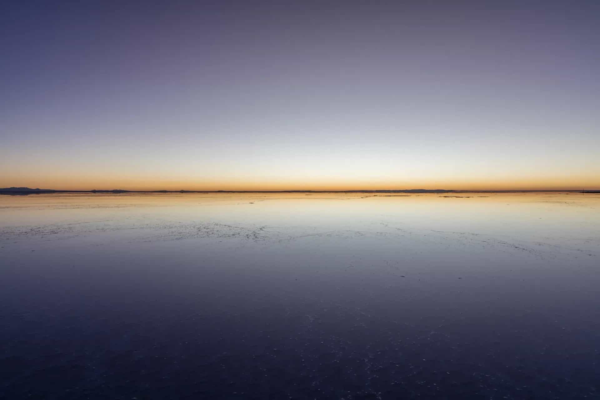
May to October is the dry season and the best window to ride: no rain, firmer roads, and the Altiplano cold but predictable. If your priority is the mirror effect at the Uyuni salt flats, you'll need December to April instead — the rainy season floods a thin layer of water over the salt, but access roads get muddier and some sections may close after heavy rain, so check conditions locally before committing.
ENTERING BOLIVIA BY MOTORCYCLE
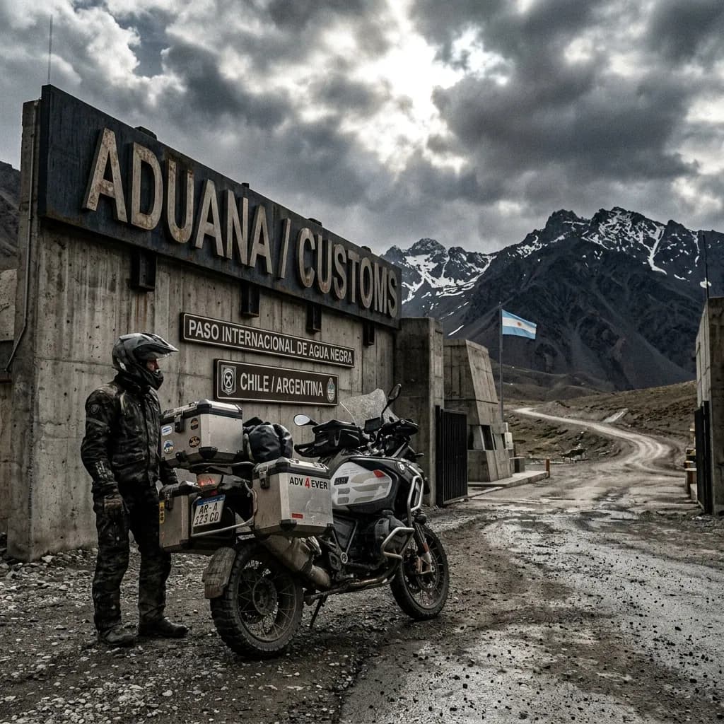
Crossing into Bolivia with a bike is, on paper, one of the more straightforward procedures in the region — the classic route from Lake Titicaca at Copacabana/Kasani is described by riders as calm and orderly. According to Bolivia's National Customs and rider accounts on Mad or Nomad and Horizons Unlimited, the process has two steps:
Immigration: DIGEMIG stamps your passport on entry and confirms your authorized days of stay.
Customs: Issues the SIVETUR (temporary import permit) for the motorcycle: you scan a QR code, fill out a simple form in the system, and get it stamped right at the post.
SIVETUR is free — no charge, per Bolivia's National Customs authority.
Real friction point:it's not the paperwork itself, it's fuel. By law you must pay the international price at the pump (around Bs 8.68/liter of gasoline versus the roughly Bs 6.96 Bolivians pay, about 25% more), but plenty of stations — especially small private ones — flatly refuse to sell to a foreign plate because their billing system can't process the price difference. It's common enough that Bolivia's own hydrocarbons regulator (ANH) set up a complaint line (72072300) for stations that refuse to sell.
Prioritize official YPFB stations, keep a spare fuel canister, and join the Bolivia overlanders WhatsApp/Facebook groups before you cross — they track which stations are actually serving foreigners day to day, which matters even more during the fuel shortages and roadblocks that hit Bolivia hard through 2026.
REQUIRED DOCUMENTATION
Passport: Valid for the whole length of your stay. Check whether your nationality needs a visa (US citizens do; EU, UK, Canada, Australia and most of Latin America don't, up to 90 days).
Driving license: Your home country's license is enough.
Motorcycle title/registration: If you're not the registered owner, you need notarized power of attorney from them plus authorization from the Bolivian consulate in your country.
SIVETUR form: Sworn declaration for entry and exit of tourist vehicles. You fill it out in National Customs' system, via a QR code with wifi available right at the crossing.
SOAT insurance (if staying more than 30 days): Foreign-plated vehicles are exempt for the first 30 days. After that it's mandatory, but getting it locally with a foreign plate isn't a standardized process — better to travel with international coverage already arranged.
With these documents sorted, entering Bolivia is a routine border procedure — the real work happens afterward, on the road. The two things that actually trip up motorcycle travelers here aren't the paperwork: they're fuel access as a foreign plate and the country's frequent road blockades, both worth planning around before you commit to a route.
Real friction point:re-read the fuel section above before you leave the border town — it will save you a wasted afternoon at a pump that refuses to sell to you.
DAILY BUDGET
This price range combines cheap lodging, cooking your own meals, and basic bike maintenance — the three categories that weigh most on any moto traveler's daily budget.
Your real daily budget is something you build yourself, based on your own needs and limits — but if you want an idea of how to build yours, pick a category to see the full guide:
Full cost breakdown in the budget guide
THE 10 BEST MOTORCYCLE ROUTES IN BOLIVIA
Bolivia doesn't have one single mythical road that sums it all up, the way Argentina has Ruta 40 — the whole country works as one extreme circuit, with an average Altiplano altitude above 3,700 meters. We picked these 10 routes by checking what the international motorcycle travel community (Horizons Unlimited, ADVrider, Mad or Nomad, and reference riders like Itchy Boots) documents again and again as the country's essentials, from the 3,500-meter descent of Death Road to the 500 kilometers of sand and geysers on the Ruta de las Lagunas.
We also aimed for real diversity: Bolivia goes from 6,000-meter glaciers to Amazon jungle to colonial mining towns in the same week of travel, so these 10 routes cross six different departments —La Paz, Oruro, Potosí, Cochabamba, Santa Cruz and Beni— so the list doesn't repeat the same landscape ten times over. And since fuel dictates the itinerary in Bolivia more than in any other country in the region, fuel range always shows up as the first warning on every card, not as a footnote.
Several of these routes —the Lagunas one, the Huayna Potosí one, the Sajama one— leave you hours from the nearest workshop, so before heading out it's worth reviewingthe mechanics guide for long motorcycle trips, covering the basics you need to be able to fix yourself out on the Altiplano.
And if paying the international fuel price on a foreign-plated bike worries you —it's real, we cover it above—,the motorcycle travel budget guidehelps you work out how much that difference weighs on the total trip.
Death Road:La Paz to Coroico through the Yungas
La Paz (La Cumbre–Coroico)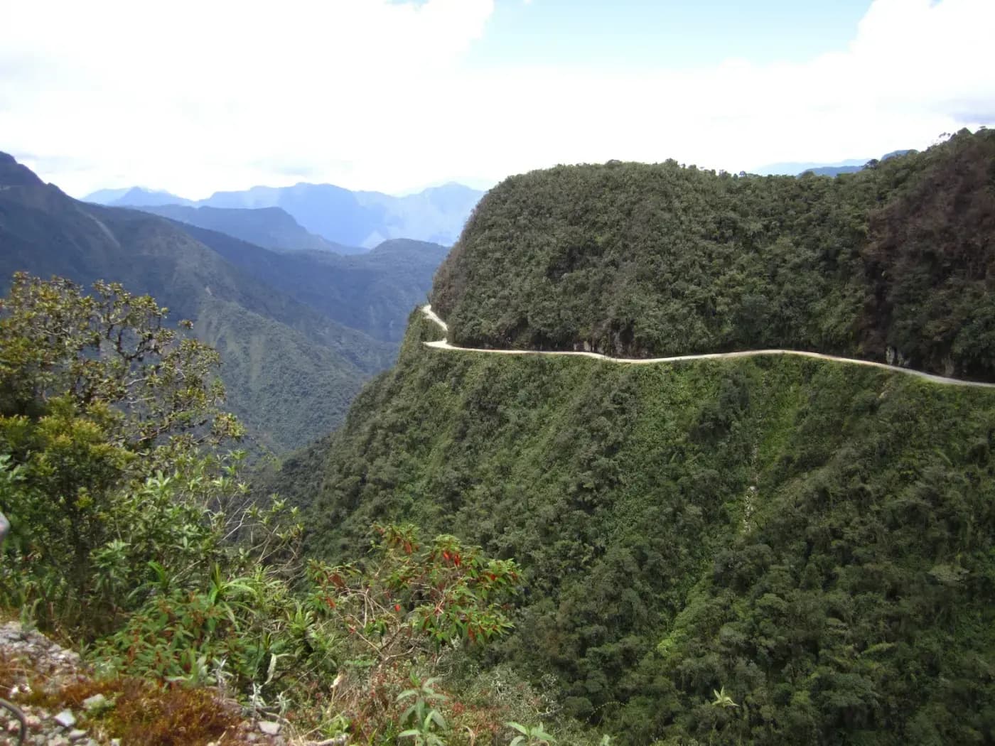
Riding Death Road by motorcycle means dropping 3,500 meters of elevation in just 64 kilometers, from the frozen La Cumbre pass down into the subtropical jungle around Coroico — probably the most brutal single-stretch elevation drop you can ride anywhere in South America.
It was built in the 1930s by Paraguayan prisoners captured during the Chaco War, originally meant as military access into the Amazon. In 1995 the Inter-American Development Bank officially branded it "the world's most dangerous road," with historical estimates of 200 to 300 deaths a year before a new paved route opened in 2006 and absorbed almost all cargo and passenger traffic.
To this day it's the only road in Bolivia where you drive on the left — a rule that dates back to when truck drivers needed to see the cliff edge from their own window. With heavy traffic diverted to the new road, what's left is a corridor almost exclusive to adventure motorcyclists and cyclists, wrapped in cloud forest.
WARNINGS FOR THIS ROUTE
This is what you need to sort out before riding this route.
- 01Fuel range
No stations along the road. Fill up in La Paz/El Alto before La Cumbre; the next reliable station is in Coroico.
- 02Blind curves at the cliff edge
It's a narrow single-lane, two-way road with drops of over 600 meters and no guardrail; historical records cite up to 200-300 deaths a year before 2006, and at least 18 cyclist deaths alone have been documented since 1998. Never ride it at night or in fog.
Ruta de las Lagunas through the Sur Lípez
Potosí (Uyuni–San Pedro de Atacama, Chile border)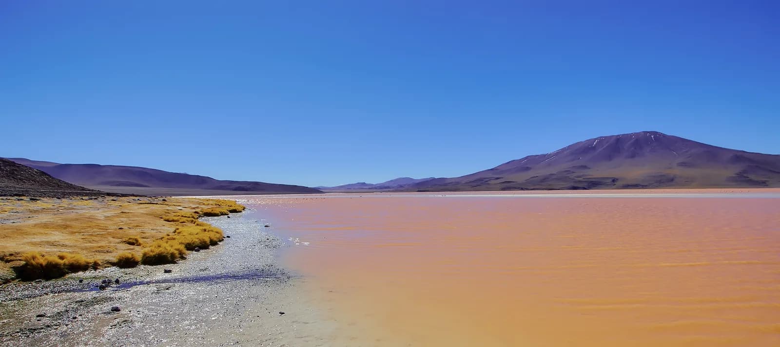
Riding the Ruta de las Lagunas by motorcycle means crossing, at an average altitude of nearly 4,000 meters, one of the rawest and most remote regions on the planet — riders worldwide (Mad or Nomad, ADVMoto, and Itchy Boots, who documented riding it solo) all describe it as one of the toughest, most isolated off-road routes there is.
The entire ride falls inside the Eduardo Avaroa Andean Fauna National Reserve and strings together landscapes that feel like another planet: Laguna Colorada, stained red by algae and sediment and home to thousands of flamingos, including the rare James's flamingo; the Sol de Mañana geysers; and the Salvador Dalí Desert, named for how the rock formations themselves recall the painter's landscapes.
It ends at Laguna Verde, an intense green from dissolved arsenic in the water, at the foot of Licancabur volcano — the exact point where Bolivia becomes Chile and the Bolivian Altiplano gives way to the Atacama desert.
WARNINGS FOR THIS ROUTE
This is what you need to sort out before riding this route.
- 01Fuel range
Critical. The last reliable station is in San Cristóbal, about 90 km before Uyuni; in Alota fuel is only sold in bottles. Jerry cans are mandatory to cover the remaining 400+ km to San Pedro.
- 02Loose sand and washboard
Constant tourist 4x4 traffic leaves deep washboard ruts and loose sand traps, especially in the southern half; several riders document falls on that stretch for exactly that reason. Drop your tire pressure and avoid riding it at night.
Crossing the Salar de Uyuni
Potosí (Uyuni–Colchani–Incahuasi Island)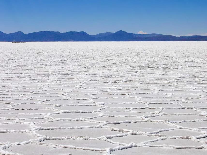
Crossing the Salar de Uyuni by motorcycle means riding across the world's largest salt desert: 10,582 km² of white crust at 3,656 meters of altitude, 2 to 10 meters thick under your wheels. In the dry season, daily thermal expansion and contraction draws the pattern of near-perfect hexagons that's become the iconic image of the place.
Right at the edge of Uyuni sits the train cemetery, locomotives rusting since the 1940s and abandoned when the mining activity in Potosí and Oruro that brought them here collapsed — a rusted industrial contrast right before you ride into the salt flat's infinite white.
For any motorcycle traveler, salt is the silent enemy: it's extremely corrosive to chains, rims and metal parts, so washing the bike down with fresh water the moment you leave the flat isn't optional — it's the difference between a healthy bike and one that starts rusting from the inside within days.
WARNINGS FOR THIS ROUTE
This is what you need to sort out before riding this route.
- 01Fuel range
Good at the access points (stations in Uyuni and Colchani), but zero inside the flat itself: plan every stretch from solid ground.
- 02Salt corrodes the bike
Riders who cross the flat agree the salt is extremely corrosive to the chain, rims and engine — wash the whole bike down with fresh water the moment you get off the salt, don't wait until you reach the hotel.
The Che Guevara Route:Vallegrande and La Higuera
Santa Cruz (Vallegrande–La Higuera)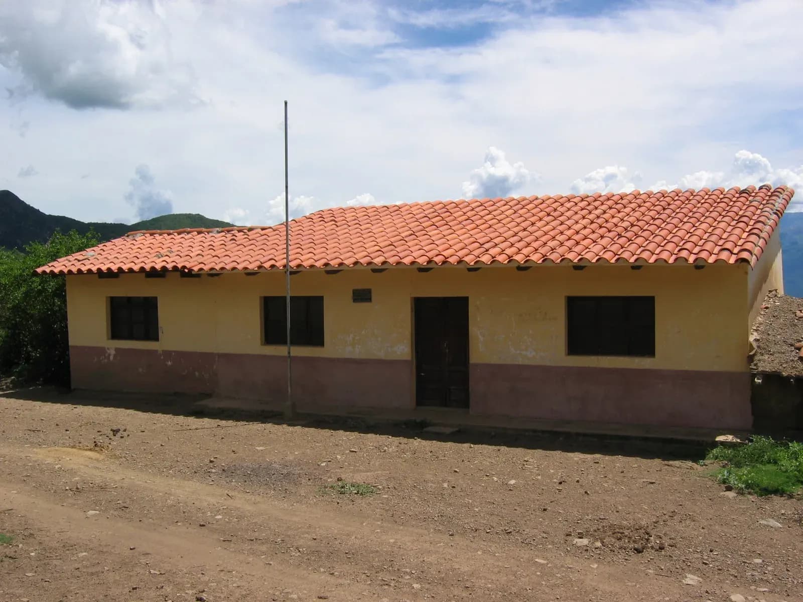
Riding the Che Guevara route by motorcycle means retracing, in reverse, the final stretch of the manhunt that ended Ernesto "Che" Guevara's life: 63 km of mountain curves between Vallegrande and La Higuera, the village where he was executed on October 9, 1967, a day after being captured wounded nearby at the Quebrada del Yuro.
The La Higuera schoolhouse where he spent his last night still stands and now works as a small site museum; his body was taken to Vallegrande and displayed in the laundry room of the Nuestra Señora de Malta hospital, buried in secret, and only repatriated to Cuba in 1997 after his remains were found.
It's, without question, the route with the most historical weight in this entire Bolivian Top 10 — a ride that any motorcycle traveler interested in 20th-century Latin American history ends up doing sooner or later, over the same ground that the whole Valles Cruceños region still calls the "Ruta del Che."
WARNINGS FOR THIS ROUTE
This is what you need to sort out before riding this route.
- 01Fuel range
Fair. Last reliable station is in Vallegrande; La Higuera has no station, only occasional informal sales.
- 02Fog and cold on the high stretch
Between Pucará and La Higuera, in the heart of the Bolivian winter (June-August), there are reports of thick fog and even the occasional light snowfall despite it being the dry season — leave early to cross that stretch with daylight and visibility.
La Paz to Copacabana across Lake Titicaca
La Paz (via the Strait of Tiquina)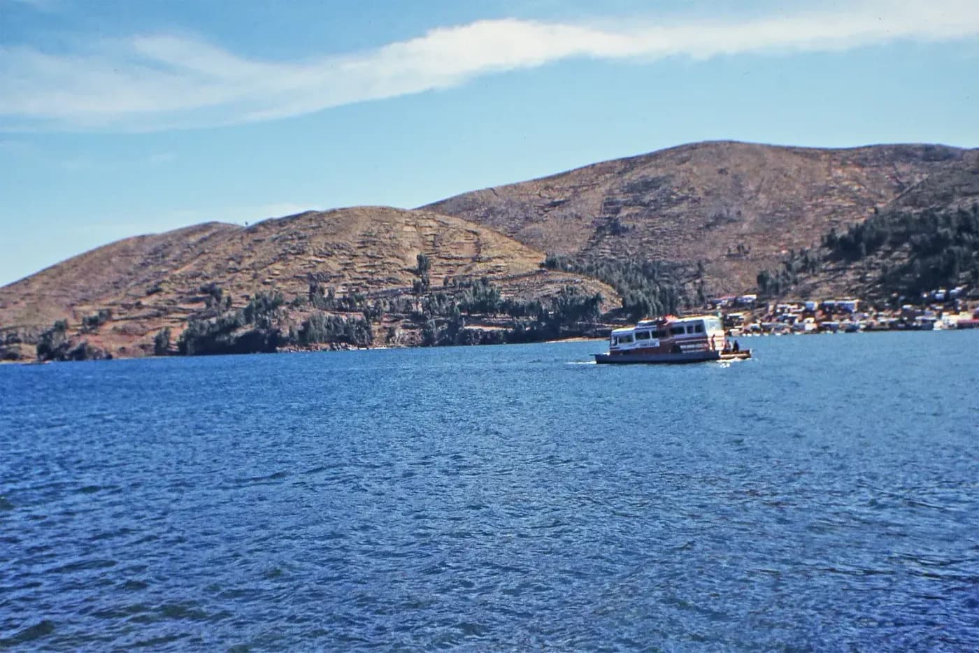
Riding into Copacabana by motorcycle along the shore of Titicaca has one unavoidable stop halfway there: the Strait of Tiquina, a channel barely 800 meters wide separating the two halves of the world's highest navigable lake, at 3,812 meters above sea level.
Since no bridge was ever built, motorcycles and passengers cross on small boats while cars and buses ride separate wooden ferries — a crossing of just a few minutes that remains, to this day, the only way across the strait by land.
On the other side, the road hugs the lake all the way to Copacabana, with Tiwanaku as an easy detour for anyone who wants to add Bolivia's best-preserved pre-Inca ruins before ending the day facing the water, in the highest city in the world on the shore of a navigable lake.
WARNINGS FOR THIS ROUTE
This is what you need to sort out before riding this route.
- 01Fuel range
Good. Regular stations in El Alto, Huarina and Copacabana.
- 02Respect the ferry crossing order
The current system of crossing passengers separately, in small boats, was adopted after a bus carrying students overturned on a ferry and several people died — today motorcycles and passengers cross apart from the vehicles for safety.
Cochabamba to Torotoro:Bolivia's "Jurassic Park"
Cochabamba (Cochabamba–Torotoro National Park)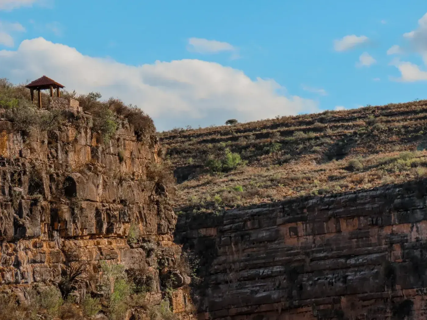
Riding into Torotoro by motorcycle means entering a national park that packs in, without exaggeration, world-class dinosaur tracks: around 2,000 footprints roughly 130 million years old, from sauropods and theropods, stamped directly into the rock that the access road itself crosses.
Underground sits the Umajalanta cave, Bolivia's deepest and longest, running 7 km with a depth of 144 meters, just 8 km from the village — a total contrast with Torotoro's open canyon, visible cutting through the plateau right from the village lookout.
Declared a national park in 1989, it's still far less visited than the Uyuni salt flat, so the rider who makes it out here finds nearly empty mountain roads and a village that still feels genuinely isolated, despite being only 140 km from Bolivia's fourth-largest city.
WARNINGS FOR THIS ROUTE
This is what you need to sort out before riding this route.
- 01Fuel range
Limited. Fill up in Cochabamba; the village of Torotoro has informal fuel sales, but they're not guaranteed.
The Huayna Potosí off-road route
La Paz (Zongo–Tuni, at the foot of Huayna Potosí)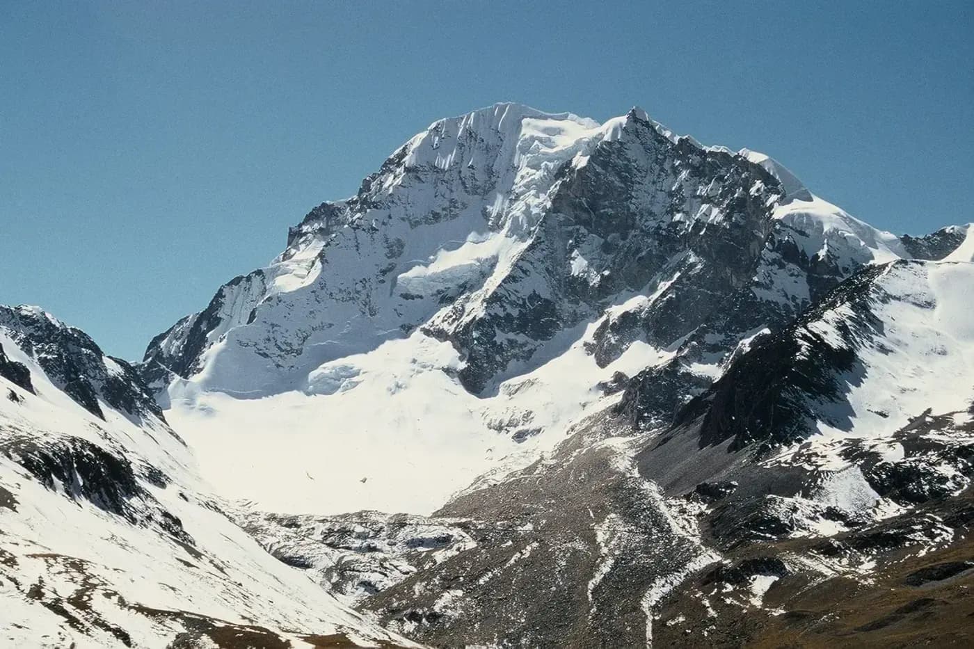
Riding up toward Huayna Potosí by motorcycle means taking on one of the least documented routes on the whole continent — Mad or Nomad, the specialized site that actually rode it, calls it "one of the best rides in South America" while at the same time admitting it's barely recorded or photographed anywhere.
The track climbs on 100% gravel, loose sand and deeply rutted sections up to nearly 5,000 meters of altitude, at the foot of the 6,088-meter peak that crowns the Cordillera Real — with no village, no fuel station and no phone signal the entire way.
Riders who've done it recommend splitting it over two days, with a night at the Tuni lodge halfway, because between the extreme altitude and a section of track that simply doesn't show up on Google Maps, it's not a route to improvise or push through in one go.
WARNINGS FOR THIS ROUTE
This is what you need to sort out before riding this route.
- 01Fuel range
None along the route. Fill up completely in La Paz — there's no service of any kind, not even for emergencies, the whole way.
- 02The track is missing from the maps
A section of the road is missing from Google Maps, according to riders who've done it — use Maps.Me or another offline app and confirm the route with the Tuni lodge before setting out.
The old highway through La Siberia to Samaipata
Cochabamba to Santa Cruz (Epizana–Comarapa–Samaipata stretch)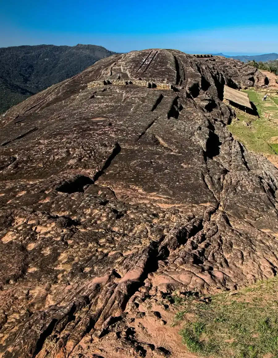
Riding La Siberia by motorcycle means taking the old highway between Cochabamba and Santa Cruz instead of the new expressway — a deliberate detour along the Epizana-to-Comarapa stretch that Bolivian truckers themselves nicknamed "La Siberia" for the cold and fog that settle over the road at altitude, before it starts dropping toward the lower valleys.
The route ends in Samaipata, home to El Fuerte, a UNESCO World Heritage archaeological site that blends three distinct cultures —Chané, Inca and Spanish— all carved into a single giant rock that crowns the town.
It's the old highway that riders looking for real mountain curves choose today over the flat, featureless new expressway: cloud cover, fog and the dense green of the Chapare yungas fading behind you as the road drops east toward the Santa Cruz lowlands.
WARNINGS FOR THIS ROUTE
This is what you need to sort out before riding this route.
- 01Fuel range
Fair. Stations in Epizana and Comarapa; nothing guaranteed in between.
- 02Fog and landslides at altitude
Bolivian news outlets report frequent blockages on this stretch from landslides and dense fog during the rainy season — check the road's status before heading out, especially between November and March.
From the Yungas to the Amazon:La Paz to Rurrenabaque
La Paz–Beni (Route 3, via Caranavi)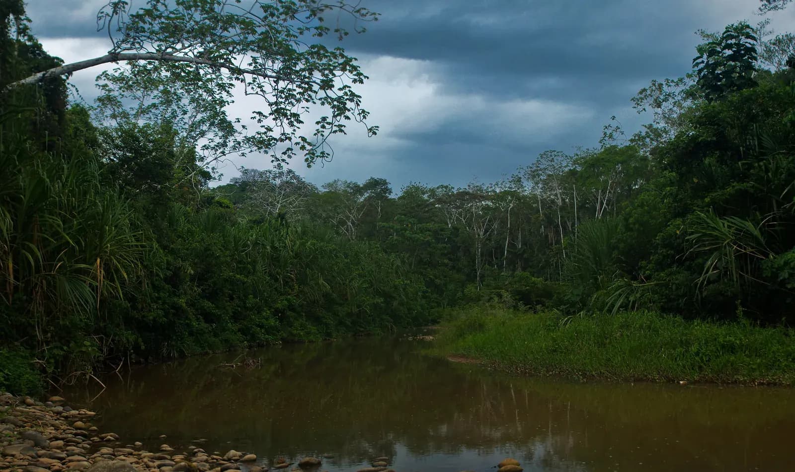
Descending from the Yungas to the Amazon by motorcycle on Route 3 means crossing nearly every ecological zone Bolivia has in a single long day: you leave La Paz at 3,600 meters, climb even higher at the La Cumbre pass, then drop without stopping through the Yungas cloud forest down to the 200-meter lowlands of the Beni.
Caranavi, at 976 meters and 168 km from La Paz, marks the point where the landscape stops being Andean and becomes fully Amazonian — from there the road runs through Palos Blancos and Yucumo before reaching Rurrenabaque, the gateway to Madidi National Park, one of the most biodiverse protected areas ever recorded on the planet.
It's the route riders choose once they've already crossed the Andes and want their first real contact with the Bolivian Amazon without flying: from snowcapped peak to warm jungle river in under 450 kilometers.
WARNINGS FOR THIS ROUTE
This is what you need to sort out before riding this route.
- 01Fuel range
Good as far as Caranavi, with regular stations. Between Caranavi and Rurrenabaque there are stretches of over 100 km without reliable fuel.
- 02Landslides and mud in the rainy season
This is a region with heavy rainfall and frequent reports of landslide blockages in Bolivian news outlets — avoid the rainy season (November-April) if you can choose when to travel.
Sajama volcano along Ruta 4
Oruro (Patacamaya–Sajama, near the Chile border)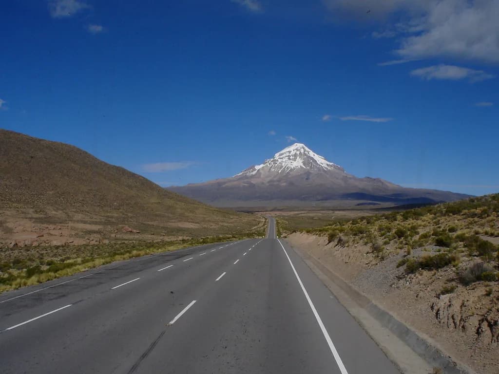
Riding toward Sajama by motorcycle means covering Route 4 with Bolivia's highest peak in front of you for dozens of kilometers — Sajama volcano tops out at 6,542 meters and dominates the entire Oruro Altiplano long before you actually reach it.
The highway skirts the volcano's southeastern flank barely 18.6 km from the Chilean border at Tambo Quemado, and a 12 km detour leads to Sajama village, inside the national park of the same name.
At the foot of the peak sit natural hot springs above 4,200 meters, inside the very first national park Bolivia ever declared, back in 1939 — while you ride, it's common to pass herds of vicuñas grazing right at the edge of the pavement, unbothered by the engine.
WARNINGS FOR THIS ROUTE
This is what you need to sort out before riding this route.
- 01Fuel range
Fair. Stations in Patacamaya and Curahuara de Carangas; the village of Sajama has no station.
NEIGHBORING COUNTRIES
Crossing the border next? Click a country to see its 10 best motorcycle routes.


FREQUENTLY ASKED QUESTIONS
01Do I need a visa to enter Bolivia by motorcycle?
+
Do I need a visa to enter Bolivia by motorcycle?
It depends on your nationality. EU, UK, Canadian, Australian and most Latin American citizens enter visa-free for up to 90 days. US citizens do need to apply for a visa in advance. Always check the current requirement for your passport before crossing.
02What is SIVETUR and how much does it cost?
+
What is SIVETUR and how much does it cost?
It's the temporary import permit for tourist vehicles issued by Bolivia's National Customs right at the border crossing. It's free and granted for a maximum of 90 days; if you don't take the bike out of the country within 20 days of expiry, Customs can seize it.
03Do I need SOAT insurance to enter Bolivia with a foreign motorcycle?
+
Do I need SOAT insurance to enter Bolivia with a foreign motorcycle?
Foreign-plated vehicles entering temporarily are exempt from SOAT for the first 30 days, per Bolivia's insurance regulation. After that it becomes mandatory, but arranging it locally with a foreign plate isn't a clear, standardized process — the safer bet is to travel with international liability coverage already arranged before you leave home.
04Why is gasoline more expensive for foreign motorcycles in Bolivia?
+
Why is gasoline more expensive for foreign motorcycles in Bolivia?
Bolivia subsidizes fuel for its own vehicles, but by law foreign-plated vehicles must pay the international price — around Bs 8.68 per liter versus the roughly Bs 6.96 Bolivians pay, about 25% more. On top of that, many small stations can't bill that differentiated price and simply refuse the sale, so it's worth prioritizing YPFB stations.
05Is the Chapare region dangerous for a motorcycle traveler?
+
Is the Chapare region dangerous for a motorcycle traveler?
Yes, it's the only region in the country under an explicit "do not travel" warning from governments like Canada's, due to drug trafficking, anti-foreigner sentiment and frequent blockades by coca growers. If you need to go from Cochabamba to Santa Cruz, it's the only road (Route 4) — check the blockade status before leaving and avoid stopping longer than necessary.
06What's the best time to ride to the Uyuni salt flats?
+
What's the best time to ride to the Uyuni salt flats?
Depends what you're after: May to October (dry season) gives the best riding surface, with no water and no risk of getting stuck. December to April (rainy season) produces the famous mirror effect, but access can get tricky and salt corrodes radiators and brakes — wash the bike with fresh water as soon as you leave the flat.
07Are road blockades common in Bolivia?
+
Are road blockades common in Bolivia?
Yes, and in 2026 they became especially frequent due to the fuel crisis and associated protests, with dozens of active blockade points across several departments at once. Before setting off on a long route, check the Bolivian Road Administration's (ABC) passability map or same-day local news reports.
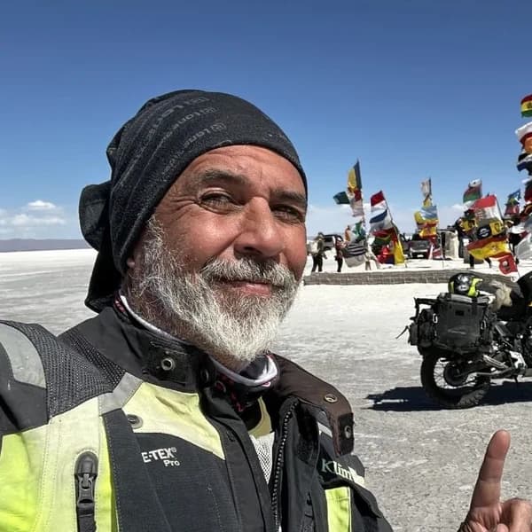
Gustavo Correa
Moto traveler, author and motorcycle travel consultant. 110,000+ km across 4 continents with Gloria, my motorcycle. Everything you read here has been tested on the road, not in an office.
Read my story →Last verified: 2026-08-29
A GIFT FOR BEING HERETHE ADVENTURE OF LIVING FREE
Do fear or doubt paralyze you before starting any project? You're not alone — every one of us has been there.
As a thank-you for visiting my site, I'm giving you my book "The Adventure of Living Free". A manual built to bring some light through the shadows and show you the philosophy that has let me ride the world for years.
* PDF STRAIGHT TO YOUR INBOX. NO SPAM.