MOTORCYCLE TRAVEL IN Brazil
QUICK ANSWER
Brazil is South America's biggest country and, for the motorcycle traveler, the one that varies the most: from the mountain curves of Santa Catarina and Rio Grande do Sul to the dirt tracks of the Amazon. Entry is straightforward at the main crossings — passport, driving license and registering the vehicle (e-DBV) right there at customs — but the insurance situation depends on your plates: a Mercosur-registered bike needs the Carta Verde bought before crossing, while other foreign plates have no equivalent local insurance requirement.
WHAT YOU NEED TO KNOW
The country you're about to enter has particularities you need to know.
Before you cross the border there are four things you need locked down: how safe the country is, what insurance is mandatory for your motorcycle, where you'll actually find fuel, and when to go. None of these are optional.
SAFETY: MODERATE RISK (3/5)
Is Brazil safe to enter by motorcycle? Yes, on the roads and at the hours a motorcycle traveler normally rides — the real risk sits in a few specific urban access points, not on the highways between cities.
AREAS TO AVOID
- Linha Vermelha, Rio de Janeiro: The expressway connecting the airport to downtown runs alongside the Complexo da Maré; there's a track record of robberies and shootouts that shut down traffic, especially near Vigário Geral. At night, use Avenida Brasil as an alternative.
- Southern periphery of São Paulo (Grajaú, Capão Redondo, Jardim Ângela): Estrada do M'Boi Mirim and Estrada de Itapecerica concentrate the city's motorcycle robberies, peaking between 6 pm and midnight — avoid them at night if GPS routes you through there.
- Favelas in any city: Complexo do Alemão, Rocinha or Cidade de Deus (Rio) and their equivalents in other cities are rated Level 4 ("Do Not Travel") by the US State Department, even on guided tours — not even the police can guarantee your safety inside.
WHERE TO PARK
- Parking: On the street: fine by day in areas with foot traffic. After dark, look for a gated lot or a gas station forecourt with cameras — common along Brazil's main highways.
- Alarm: Recommended: yes, especially in São Paulo, Rio and the northeastern capitals. Less critical on rural routes and in the Amazon.
- Luggage: Take off what you can carry (tank bag, backpack, camera) when parking. Many motorcycle robberies start with what's left loose in plain sight.
- Visibility: Park where there's foot traffic and good lighting — never in an alley or an empty street, not even for ten minutes.
TIPS
- ➜Don't enter Rio de Janeiro at night via the Linha Vermelha — use Avenida Brasil instead.
- ➜In São Paulo, avoid the southern periphery (Grajaú, Capão Redondo) after dark if your route allows it.
Outside those specific spots, Brazil rides easily — the vast majority of the country's highways are calm by day.
MANDATORY INSURANCE: Carta Verde (Mercosur insurance)
Mandatory only if your motorcycle is registered in a Mercosur country (Argentina, Uruguay or Paraguay): you buy it in your home country before crossing, and it covers your civil liability inside Brazil. Brazil doesn't require a local insurance equivalent to DPVAT for foreign-plated motorcycles — that mandatory Brazilian insurance only applies to vehicles registered in the country.
FUEL: SCARCE IN THE AMAZON
Excellent coverage in the south, southeast and along the coastal highways (BR-101, BR-116) — stations every few kilometers. On the BR-319 (Manaus-Porto Velho) there's a stretch of nearly 450 km with no official station between Careiro-Castanho and Humaitá; fill up in those two towns and carry extra jerry cans if you're crossing that section of jungle.
BEST SEASON: MAY → SEP
May to September is the driest window for most of the country: the Amazon has its rainy season between December and May, and the south (Santa Catarina, Rio Grande do Sul) is more pleasant outside the cold June-August winter. The northeast, by contrast, rides well almost year-round, with its best weather between September and March.
ENTERING BRAZIL BY MOTORCYCLE
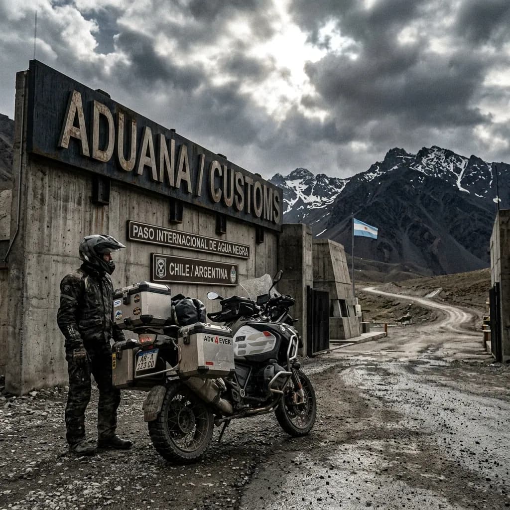
Crossing into Brazil with a bike through the main posts (Foz do Iguaçu, Uruguaiana, Chuí, Corumbá) is an orderly process according to traveler accounts on Horizons Unlimited and guides like Mad or Nomad — the country doesn't require a carnet de passage or a security deposit, just registering the vehicle right at the border post.
The process has two steps:
Polícia Federal (Immigration): Stamps your passport on entry and sets how many days you can stay (90, extendable to 180).
Receita Federal (Customs): Registers the bike with the e-DBV, the temporary admission permit, valid for the same period as your visa.
The e-DBV is free — there is no charge, according to Brazil's Receita Federal.
Real friction point:away from the major crossings, Brazilian customs staff may not be as used to processing a foreign motorcycle's temporary import, especially at jungle crossings like Assis Brasil-Iñapari (Peru border), where the road is unpaved, gets cut off in the rainy season, and they also strictly check the yellow fever certificate.
It's worth entering through a major crossing (Foz do Iguaçu, Uruguaiana, Chuí or Corumbá) and saving the remote ones for when you've already got the paperwork sorted elsewhere.
REQUIRED DOCUMENTATION
Passport: Valid for the whole length of your stay.
Driving license: Your home country's license is enough for 180 days if you're from a Mercosur country.
International Driving Permit: Recommended if your license isn't from a Mercosur country — some border posts require it.
Motorcycle title/registration: If you're not the owner, you need notarized power of attorney from them.
e-DBV (Traveler's Goods Declaration): The temporary admission permit for the bike — it can be pre-filled online but is registered in person on arrival at the border post.
Yellow fever certificate: Required at jungle crossings (e.g. Assis Brasil-Iñapari) or if you're coming from risk zones in Bolivia or Peru.
With these six documents sorted, entering Brazil with a bike through a main crossing is routine. The advice that comes up most often among motorcycle travelers: if your bike is registered in a Mercosur country, buy the Carta Verde before crossing — it isn't sold at the border post itself, so trying to sort it out on the spot can leave you stuck on the wrong side.
DAILY BUDGET
This price range combines cheap lodging, cooking your own meals, and basic bike maintenance — the three categories that weigh most on any moto traveler's daily budget.
Your real daily budget is something you build yourself, based on your own needs and limits — but if you want an idea of how to build yours, pick a category to see the full guide:
Full cost breakdown in the budget guide
THE 10 BEST MOTORCYCLE ROUTES IN BRAZIL
Brazil is too big to have a single mythical road the way Argentina has Ruta 40: it's a country with an equatorial climate in the north and a temperate one at its southern tip, so the routes that truly matter to a motorcycle traveler change completely by region. I picked these 10 not for being the country's longest highways, but for being the ones Brazilian riders themselves —on forums like El Bando Moto Clube, specialized blogs like Viagem de Moto, and communities like Horizons Unlimited and ADVrider— name again and again as must-do stops, each with at least one real source behind it. I also prioritized genuine terrain diversity: from the concrete pavement with 284 curves in Santa Catarina to the 145km of dirt and wooden bridges crossing the Pantanal, to 300km of loose sand on the northeastern coast and a stretch of the Transamazônica deep in the jungle.
Before heading out on any of these 10 routes, it's worth putting togetherthe full logistics of a long motorcycle trip, because in Brazil the distance between one repair shop and the next is sometimes measured in hundreds of kilometers.
On stretches as isolated as the Pantanal or the Transamazônica, reviewingthe mechanics guide for long motorcycle tripsbefore you leave can save you from getting stranded in the middle of nowhere.
And since in Brazil you might go from the hot sand of the northeast to the cold fog of the Serra Gaúcha in the same week, it's worth checkingthe gear guide for long motorcycle tripsbefore you pack your bags.
Serra do Rio do Rastro:the Santa Catarina Highlands
Santa Catarina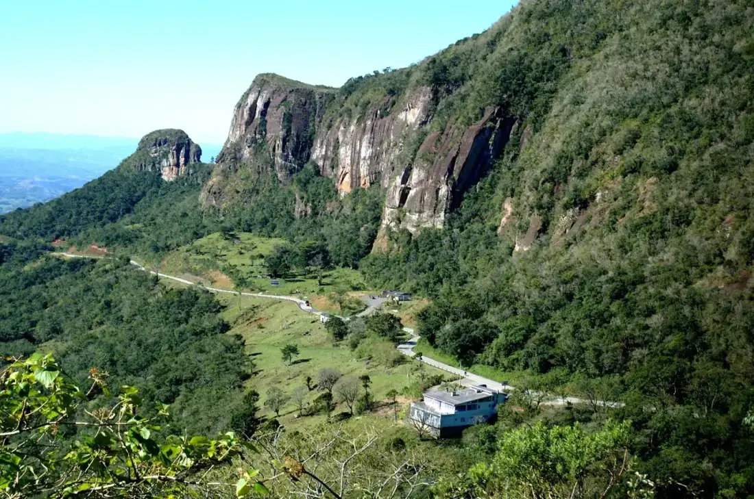
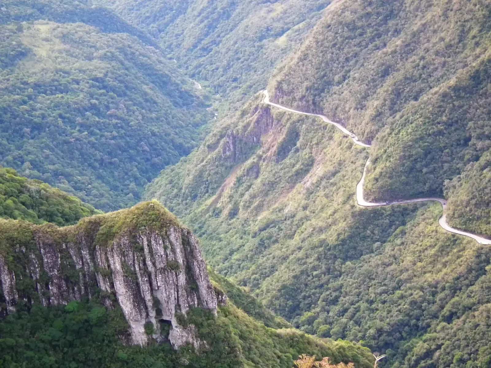
Climbing the Serra do Rio do Rastro by motorcycle means tackling Santa Catarina's most photographed postcard: 284 tight curves climbing from 200 to 1,460 meters along the SC-390, with the lookout at the top rewarding you with a view of the entire zigzag.
The road follows the same path once crossed only by mule trains hauling cattle — the range's name comes from the tracks (rastros) those animals left near the river. The route began as a dirt road only in the mid-1950s, and wasn't finished in concrete pavement until 1986, when it became the first highway in Santa Catarina with that kind of surface.
Its 284 curves are packed into just 8km, so every meter demands braking, leaning and accelerating again without a break. It's the ride every motorcycle traveler in southern Brazil does at least once, and the reason the entire Serra Catarinense became the country's motorcycling mecca.
WARNINGS FOR THIS ROUTE
This is what you need to sort out before riding this route.
- 01Fuel range
Good at both ends (Lauro Müller and Bom Jardim da Serra); no stations along the climb itself.
- 02Dense fog that cuts visibility within minutes
Highway police regularly issue dense fog alerts on the climb, especially in winter — it can cut visibility within minutes and hide the tight curves.
- 03Collisions from crossing into the oncoming lane on a curve
Several recorded accidents on the SC-390 involved motorcycles losing control on a tight curve and crossing into the oncoming lane — always stay in your lane, even on a curve you already know.
Estrada da Graciosa:the Serra do Mar in Paraná
Paraná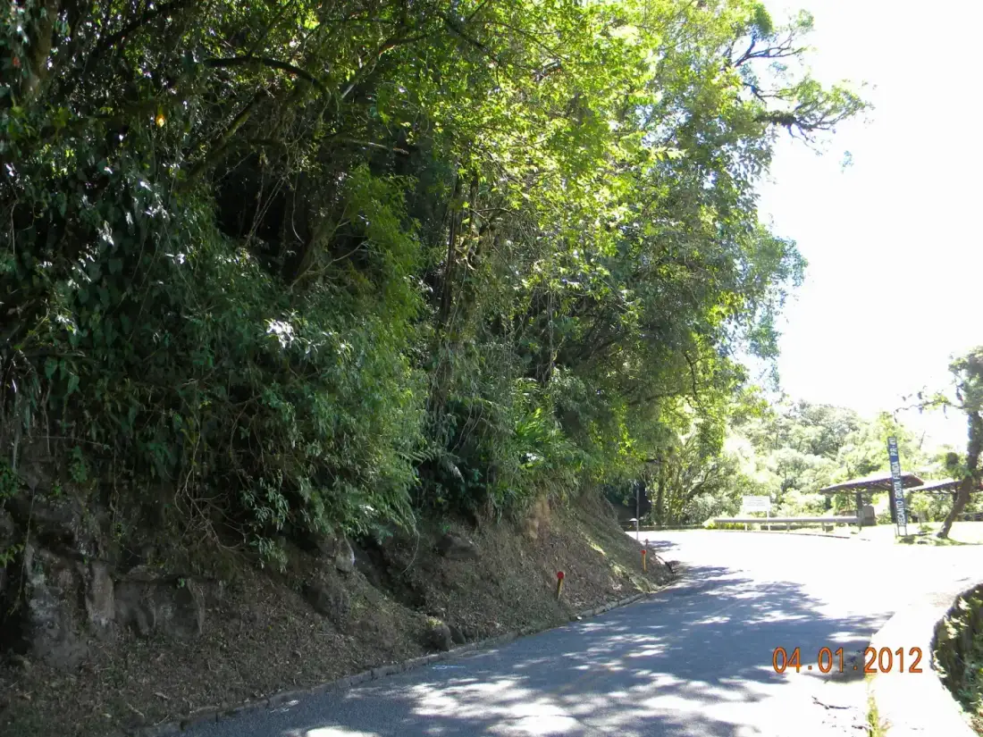
Descending the Estrada da Graciosa by motorcycle from the Curitiba plateau down to the Paraná coast means riding a road inaugurated in 1873, after Emperor Dom Pedro II himself authorized the project following the province's emancipation. Ten engineers took 19 years to finish it, slowed by dense forest, animal attacks and worker illness.
Eight kilometers of its curves still carry the original cobblestones, laid one by one by enslaved hands in the 19th century — a detail most riders today don't know, but that you feel in every brake on the uneven surface.
The stretch of Serra do Mar it crosses was declared a state heritage site in 1986 and is part of the Atlantic Forest Biosphere Reserve recognized by UNESCO. Close to Curitiba, it's the classic weekend ride for any local motorcyclist.
WARNINGS FOR THIS ROUTE
This is what you need to sort out before riding this route.
- 01Fuel range
Excellent. Full-service stations in Curitiba, Morretes and Antonina, at both ends of the descent.
- 02Slippery cobblestone in the rain
The combination of rain and cobblestone causes frequent falls — several accounts describe motorcycles and cars skidding on curves when braking on wet stone. Slow to under 30km/h on curves if the road is wet.
- 03Closures from landslides
The road closes completely when rain causes landslides onto the pavement — check road conditions before heading out during heavy rain season.
Rota do Sol:the Serra do Pinto down to the Rio Grande do Sul coast
Rio Grande do Sul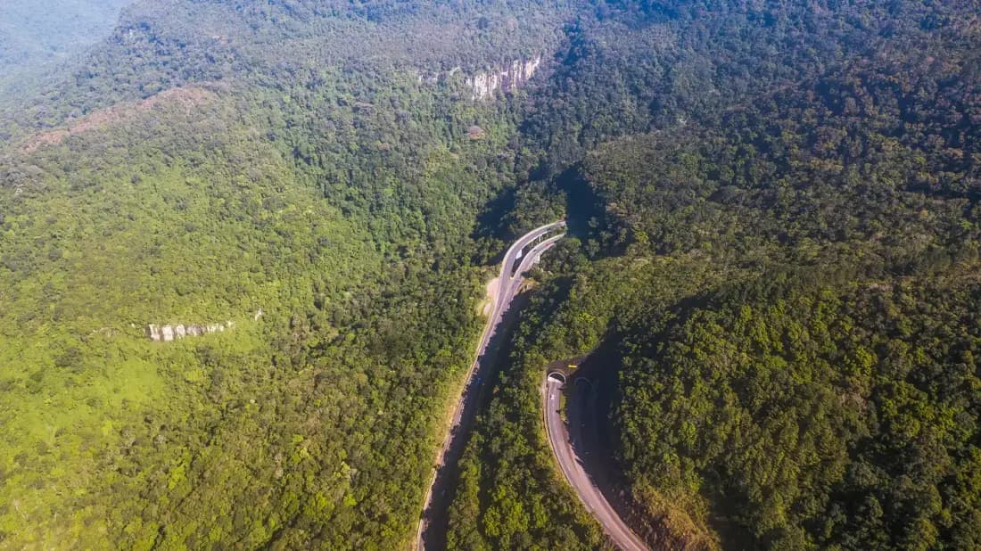
Descending the Rota do Sol by motorcycle through the Serra do Pinto means covering an elevation drop of over 700 meters in just 10km of highway — from the nearly 1,000masl of the Campos de Cima da Serra plateau down to the 60masl of Itati, near the coast.
Before this engineering existed, anyone living in the Caxias do Sul metropolitan area had to take a huge detour to reach the sea. The solution was two tunnels carved directly into the mountain rock, the largest nearly 450 meters long, known among gaúcho riders as the 'Túnel da Reversão'.
The Mirante da Serra do Pinto, overlooking the canyon and forested valley below, is the mandatory stop for anyone riding the RS-453: the mountains suddenly open up and the coastline appears as a green strip on the horizon.
WARNINGS FOR THIS ROUTE
This is what you need to sort out before riding this route.
- 01Fuel range
Excellent. Stations in Caxias do Sul, Gramado, Canela and Itati, along the entire route.
- 02Curves with wet pavement
In winter, fog and wet pavement are common on the descent from the Serra do Pinto, and several riders have reported falls on the RS-453's tight curves when the asphalt is damp — slow down as soon as it starts drizzling or you see fog.
Rio-Santos Highway:the coast between São Paulo and Rio de Janeiro
São Paulo and Rio de Janeiro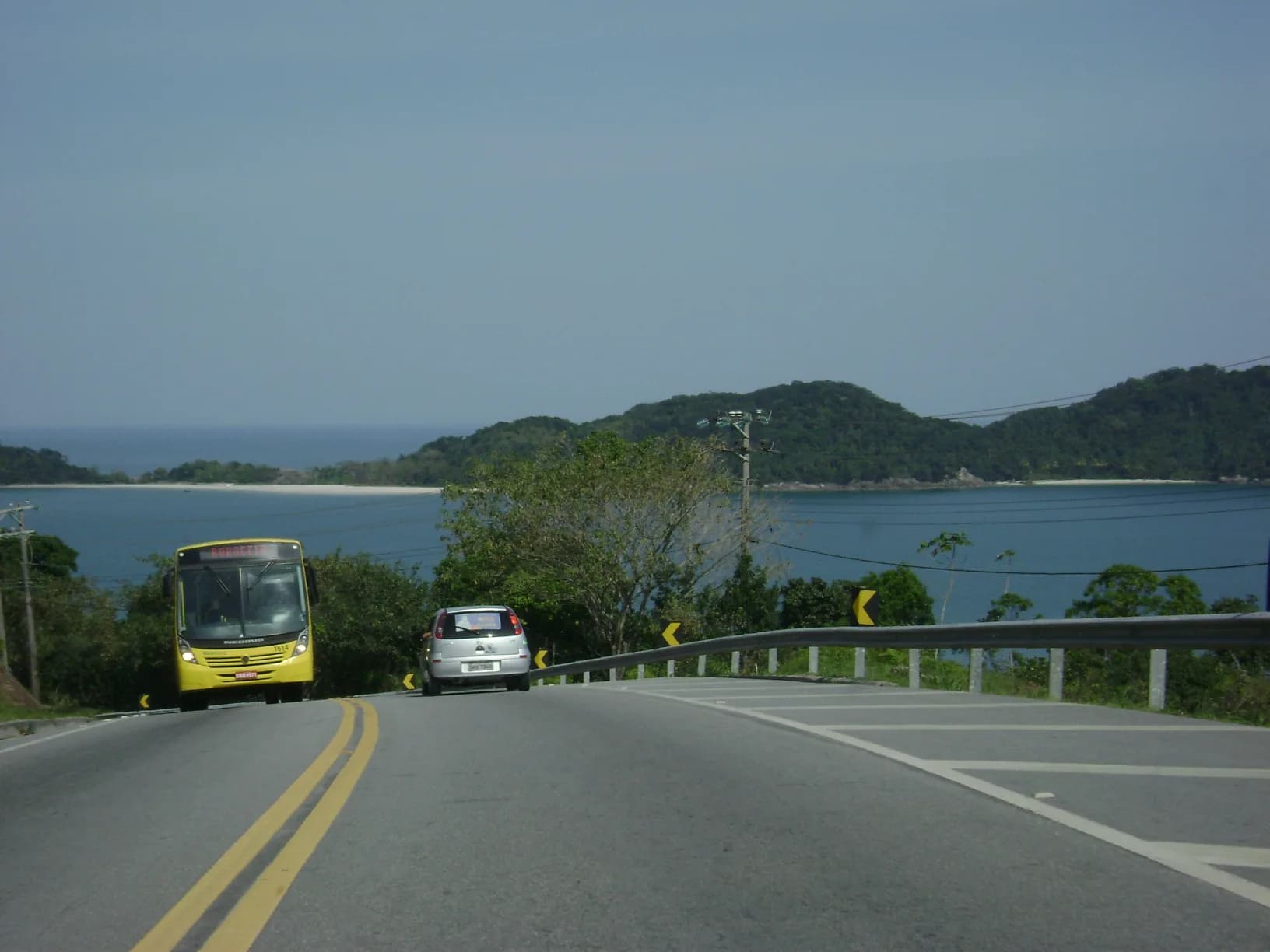
Riding the Rio-Santos Highway by motorcycle means hugging 550km of coastline between Rio de Janeiro and São Paulo on a road that took longer than planned: construction began in 1969, was supposed to finish in 1971, and was only completed in 1975 — without so much as an official opening ceremony.
The route crosses the historic territory of the Tupinambá people, once led by chief Cunhambebe, and today connects beaches that became synonymous with Brazilian motorcycle touring: Paraty, Angra dos Reis, Ubatuba, São Sebastião and, via ferry, the island of Ilhabela.
About 10,000 commercial vehicles travel this same road daily today, much of it hauling fuel from the ports of Santos and São Sebastião — which is why it pays to plan your stops outside truck rush hours. Despite the traffic, most Brazilian riders still call it the most beautiful road in the country.
WARNINGS FOR THIS ROUTE
This is what you need to sort out before riding this route.
- 01Fuel range
Excellent. Stations in every coastal town along the entire route.
- 02Overtaking trucks on curves
Thousands of trucks travel this narrow, curvy coastal route every day — several Brazilian rider forums point to overtaking trucks on curves as the most common cause of serious accidents on the Rio-Santos. Only overtake on fully straight stretches with total visibility.
Estrada Real:the Caminho Velho from Ouro Preto to Paraty
Minas Gerais and Rio de Janeiro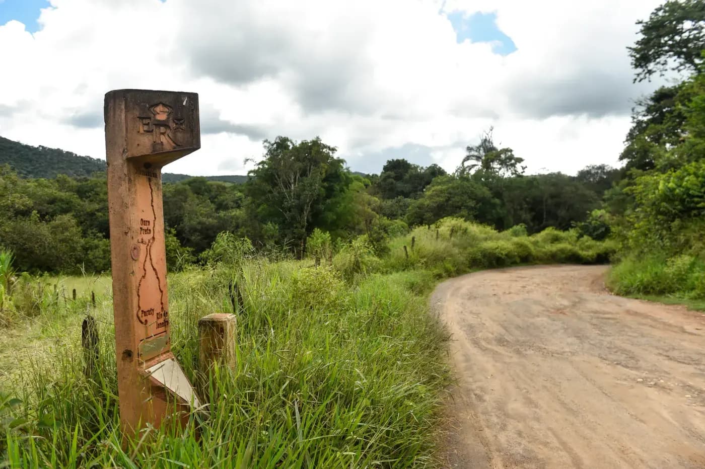
Riding the Caminho Velho of the Estrada Real by motorcycle means following the route the Portuguese Crown formalized in the mid-18th century to control tax collection on the gold and diamonds leaving Minas Gerais for the port of Rio de Janeiro. In the 17th century, the same distance took a mule caravan led by tropeiros 60 days.
Today the Instituto Estrada Real divides the full route —over 1,630km total, Brazil's longest tourist circuit— into four paths: the Caminho do Ouro, the Caminho dos Diamantes, the Caminho Novo and the Caminho Sabarabuçu. The Caminho Velho, from Ouro Preto to Paraty, is the longest of the four at 710km spread across 27 stages.
Only 18% of the route is paved or cobbled: the rest is dirt, mud and trails narrow enough that, according to rider accounts, some stretches between Ouro Preto and São Bartolomeu were built for bicycles and hikers, not big touring bikes — be ready to backtrack and find a detour.
WARNINGS FOR THIS ROUTE
This is what you need to sort out before riding this route.
- 01Fuel range
Variable. Good in the historic towns every 50-80km; none on several rural stretches — plan each stage.
- 02Impassable mud after rain
One rider reported that after a downpour near São João del-Rei, a stream overflowed and turned the road into a swamp that nearly blocked the crossing — avoid heading out right after heavy rain.
- 03Stretches not suited to big touring bikes
The stretch between Ouro Preto and São Bartolomeu is marked but was designed for bicycles and hikers: several accounts describe having to detour onto a parallel dirt or paved road because a big bike couldn't fit through.
The Transpantaneira:145km through the heart of the Pantanal
Mato Grosso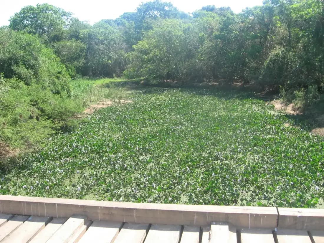
Crossing the Transpantaneira by motorcycle means riding 145km of dirt road that locals themselves named in tribute to the adventure it promises: the official name is just Highway MT-060, but nobody calls it that.
More than 120 wooden and concrete bridges cross the entire route; some, especially from kilometer 60 onward, are in poor condition or outright burned, and the Mato Grosso government is gradually replacing them with new structures. The 60km/h speed limit isn't just protocol: caimans, capybaras, jabiru storks and even snakes cross the road without warning.
The final stretch, near Porto Jofre, is world-renowned for jaguar sightings — the reason National Geographic and dozens of photo-safari operators chose this exact desolate last section of the Transpantaneira as their base of operations.
WARNINGS FOR THIS ROUTE
This is what you need to sort out before riding this route.
- 01Fuel range
Critical. No stations between Poconé and Porto Jofre — fill up completely and carry a backup jerry can.
- 02Wooden bridges in poor condition
Recent reports document rotted or outright burned wooden bridges from km 60 onward — always cross slowly and visually check each bridge before riding over it, especially toward the end of the route.
- 03Wildlife crossing the road without warning
Caimans, birds and other animals cross the road constantly and without warning — always keep to the 60km/h limit, especially at dusk.
Chapada dos Veadeiros:the GO-239 to São Jorge
Goiás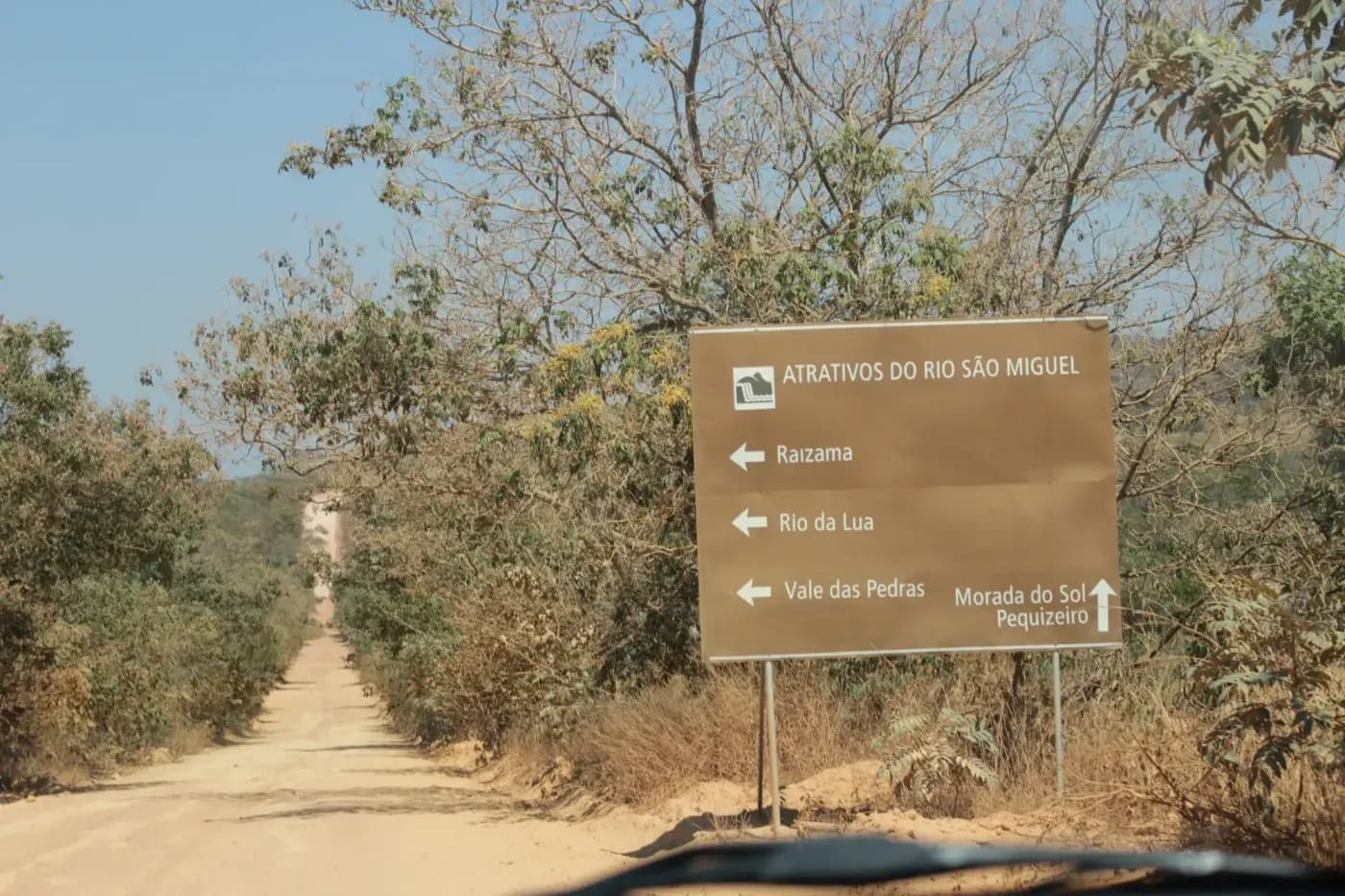
Riding the Chapada dos Veadeiros by motorcycle along the GO-239 means crossing the country's oldest highland cerrado: the rocks of the Supergrupo Veadeiros that shape the landscape are between 650 million and 2.1 billion years old, older than the Amazon and the Atlantic Forest.
The road climbs to nearly 1,676 meters at Serra do Pouso Alto, Goiás's highest point, cutting through a national park with over 120 catalogued waterfalls. In 1981 the park lost 90% of its original territory to make way for this very road — today almost the entire GO-239 up to São Jorge is paved, including the village itself, which until recently was dirt streets.
The flip side of riding through a national park is the wildlife: one study counted over 500 roadkill animals in just 16,500km surveyed along the São João da Aliança to São Jorge stretch, including a jaguar in 2016. Ride slow, especially at dusk.
WARNINGS FOR THIS ROUTE
This is what you need to sort out before riding this route.
- 01Fuel range
Good in Alto Paraíso; limited in São Jorge — fill up before entering the park.
- 02Documented wildlife roadkill
A study funded by the O Boticário Foundation recorded over 500 roadkill animals on the park's access stretches, including a jaguar in 2016 — slow down, especially at dawn and dusk.
Chapada Diamantina:to Morro do Pai Inácio
Bahia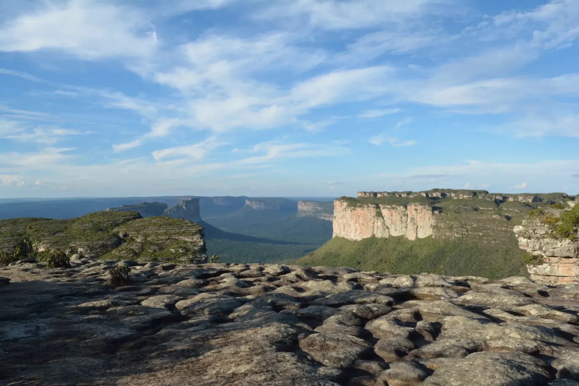
Climbing Morro do Pai Inácio by motorcycle from Lençóis, looping back through Palmeiras, Igatu and Andaraí, means entering the heart of Bahia's Chapada Diamantina via a 28km detour of badly damaged dirt road off the BR-242.
The hill, right off the BR-242, reaches 1,150 meters and rewards you with a panoramic view over the Camelo and Três Irmãos hills — it's the most photographed postcard in the entire national park. Many riders extend the loop to Igatu via the old Estrada do Garimpo, over 26km of stone-paved track left exactly as it was when garimpeiros mined diamonds from the region.
The access road to Morro do Pai Inácio crosses a stream whose flow varies a lot by season: during high water, only certain vehicles manage to cross without getting stuck.
WARNINGS FOR THIS ROUTE
This is what you need to sort out before riding this route.
- 01Fuel range
Good in Lençóis and Andaraí; none on the rural stretches of the loop.
- 02Stream crossing during high water
The dirt access road to Morro do Pai Inácio crosses a stream that during high water only lets certain vehicles through — assess the water level before crossing, or check road conditions in Palmeiras.
Rota das Emoções:dunes across Maranhão, Piauí and Ceará
Maranhão, Piauí and Ceará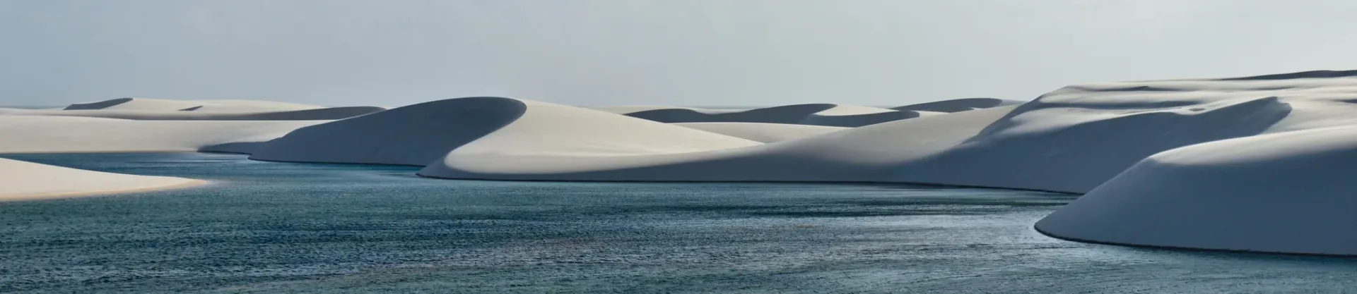
Riding the Rota das Emoções by motorcycle means crossing 14 municipalities across three northeastern states to connect three of Brazil's natural icons: the Lençóis Maranhenses, the Parnaíba Delta and Jericoacoara.
The Lençóis Maranhenses are 155,000 hectares of white dunes dotted with turquoise freshwater lagoons; they reach their fullest between June and August, right after the rainy season. The Parnaíba Delta, in the middle of the route, is the only open-sea delta in all of the Americas — its five arms flow directly into the ocean, a trait it shares only with the Nile and Mekong deltas.
It's a route originally designed for 4x4 vehicles, so on a motorcycle it demands solid loose-sand riding skill: much of the way has no pavement or signage, and tides and wind can change the sand conditions from one day to the next.
WARNINGS FOR THIS ROUTE
This is what you need to sort out before riding this route.
- 01Fuel range
Scarce on the dune stretches. Fill up in Barreirinhas, Tutoia, Parnaíba and Camocim.
- 02Loose sand and getting stuck
Much of the route has no pavement or signage — loose sand and mangroves can trap the rear wheel without warning. Travel in a group or with a guide if you don't have solid sand-riding experience.
The Transamazônica:BR-230 between Itaituba and Jacareacanga
ParáCrossing the Itaituba–Jacareacanga stretch of the Transamazônica by motorcycle means tackling one of the toughest sections of the full 4,000km BR-230 — Brazil's third-longest highway, opened on September 27, 1972 to connect the northeastern coast with the heart of the Amazon, crossing seven states.
More than 50 years after it opened, much of its length remains unpaved. The stretch between Itaituba and Jacareacanga —roughly 400km of narrow track shared with mining trucks— is considered by Brazilian riders themselves one of the worst on the entire route.
The Transamazônica connects with the BR-319, the so-called 'Ghost Highway' toward Manaus, and together they form the corridor used by expedition riders looking to cross the entire continent by motorcycle. There's no cell signal for much of the way, and riding at night is simply impossible: with no lighting or signage, the risk of misjudging a river crossing or a deep pothole is real.
WARNINGS FOR THIS ROUTE
This is what you need to sort out before riding this route.
- 01Fuel range
Critical. Fill up completely and carry a backup jerry can in Itaituba before leaving — some stretches have no service station at all.
- 02Narrow track shared with mining trucks
The Itaituba-Jacareacanga stretch has barely one usable lane and heavy traffic from mining trucks and pickups — several rider accounts flag it as the worst stretch of the entire Transamazônica. Take extra care when passing heavy traffic.
- 03Impossible to ride at night
With no lighting or signage, riding this stretch at night is flatly discouraged by those who've done it — always plan to reach your destination before dusk.
NEIGHBORING COUNTRIES
Crossing the border next? Click a country to see its 10 best motorcycle routes.






FREQUENTLY ASKED QUESTIONS
01Do I need the Carta Verde to enter Brazil by motorcycle?
+
Do I need the Carta Verde to enter Brazil by motorcycle?
Only if your bike is registered in a Mercosur country (Argentina, Uruguay or Paraguay) — you buy it before crossing, not at the border. If your plates are from outside the bloc, Brazil doesn't require an equivalent local insurance for foreign vehicles.
02How long can I stay in Brazil with my foreign motorcycle?
+
How long can I stay in Brazil with my foreign motorcycle?
The temporary admission record (e-DBV) is valid for the same period as your tourist visa: 90 days, extendable once for another 90 at the Polícia Federal, up to a maximum of 180 days per year.
03Do I need an international driving permit to enter Brazil?
+
Do I need an international driving permit to enter Brazil?
If you're from a Mercosur country, your national license is enough for 180 days. If you're from outside the bloc, it's worth carrying an International Driving Permit along with your license — some border posts ask for it and others don't, but it's not worth the risk of not having it.
04Are there gas stations throughout the Amazon?
+
Are there gas stations throughout the Amazon?
Not on the BR-319 (Manaus-Porto Velho): there's a stretch of nearly 450 km with no official station between Careiro-Castanho and Humaitá. Outside that specific route, the Brazilian Amazon has better fuel coverage than the jungle in neighboring countries.
05Do I need a yellow fever certificate to enter Brazil by motorcycle?
+
Do I need a yellow fever certificate to enter Brazil by motorcycle?
It depends on where you cross. At jungle crossings like Assis Brasil-Iñapari (Peru border), or if you're coming from risk zones in Bolivia (Santa Cruz) or Peru (Madre de Dios, Ucayali), yes, it's checked. At the main southern crossings (Foz do Iguaçu, Uruguaiana, Chuí) it isn't a routine check.
06Is it dangerous to ride into Rio de Janeiro or São Paulo by motorcycle?
+
Is it dangerous to ride into Rio de Janeiro or São Paulo by motorcycle?
Not the access roads themselves, but specific spots at night: the Linha Vermelha in Rio (near the Complexo da Maré) and the southern periphery of São Paulo (Grajaú, Capão Redondo). By day, on the main routes, riding into both cities is routine.
07What's the best time of year to ride across Brazil?
+
What's the best time of year to ride across Brazil?
May to September for most of the country (dry Amazon, south without the winter cold). The northeast rides well almost year-round, with its best weather between September and March.
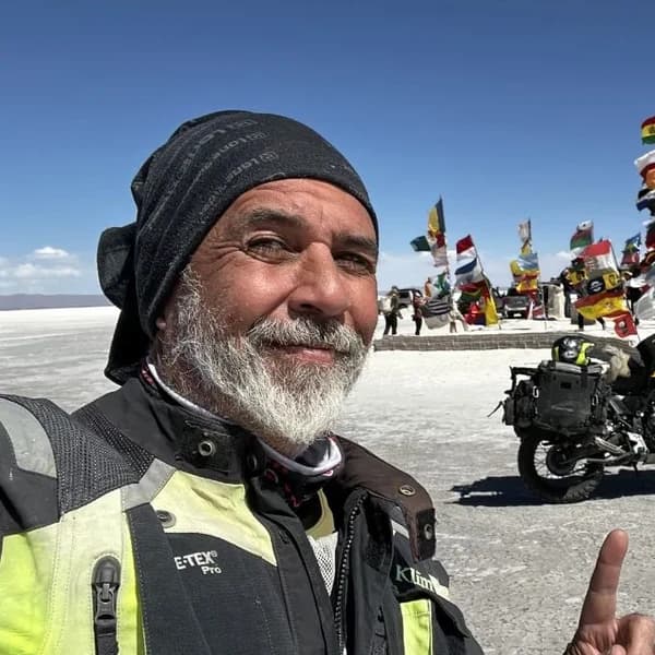
Gustavo Correa
Moto traveler, author and motorcycle travel consultant. 110,000+ km across 4 continents with Gloria, my motorcycle. Everything you read here has been tested on the road, not in an office.
Read my story →Last verified: 2026-08-29
Sources consulted (24)+
- horizonsunlimited.com
- madornomad.com
- gov.br
- gov.br
- prensamercosur.org
- seguraaicorretora.com.br
- jusbrasil.com.br
- elbando.com.br
- naestrada.site
- br.usembassy.gov
- travelwarningcheck.com
- interlira-reports.com
- metropoles.com
- baixadanaweb.wordpress.com
- en.wikipedia.org
- dgvs.mspbs.gov.py
- holasim.com
- fecombustiveis.org.br
- vivirbrasil.com
- internationaldriversassociation.com
- partedeexistencia.com
- tripadvisor.es
- commons.wikimedia.org
- en.wikipedia.org
A GIFT FOR BEING HERETHE ADVENTURE OF LIVING FREE
Do fear or doubt paralyze you before starting any project? You're not alone — every one of us has been there.
As a thank-you for visiting my site, I'm giving you my book "The Adventure of Living Free". A manual built to bring some light through the shadows and show you the philosophy that has let me ride the world for years.
* PDF STRAIGHT TO YOUR INBOX. NO SPAM.