MOTORCYCLE TRAVEL IN Peru
QUICK ANSWER
Peru is the gateway to the Andes and to high-altitude routes like Abra Málaga or the Colca Canyon, some of the most spectacular in South America. Entry is straightforward if your paperwork is in order: passport, motorcycle title, and SOAT — the mandatory traffic accident insurance — which you buy right at the border crossing or online before you cross.
WHAT YOU NEED TO KNOW
The country you're about to enter has particularities you need to know.
Before you cross the border there are four things you need locked down: how safe the country is, what insurance is mandatory for your motorcycle, where you'll actually find fuel, and when to go. None of these are optional.
SAFETY: MODERATE RISK (3/5)
Is Peru safe to enter by motorcycle? Yes, but with more care than its southern neighbors — the risk is concentrated in specific spots, not along the whole route.
AREAS TO AVOID
- San Juan de Lurigancho and El Agustino (Lima): The districts with the most reported crime in Lima according to INEI, with rising extortion and armed robbery — avoid crossing them at night even if GPS shows the shortest route.
- Callao and the area around Gamarra (La Victoria): The port area and market with a presence of gangs and "motochorros" (two people on a bike who rob passersby) — stick to the main avenues.
- VRAEM (Apurímac, Ene and Mantaro river valley): An area with remnants of Sendero Luminoso and active drug trafficking, off any touristic route — the Peruvian government and foreign embassies flag it as a zone to avoid entirely, not just after dark.
- The Puno-Juliaca corridor toward the Bolivian border: Historically the area with the most road blockades from protests (the worst episode being the 2023 Juliaca massacre) — check the road status before crossing into Bolivia via Desaguadero or Kasani.
WHERE TO PARK
- Parking: On the street: fine by day and with foot traffic around. After dark, look for a hospedaje with its own garage or a grifo (gas station) with cameras.
- Alarm: Recommended: yes, especially in Lima and Callao. Less critical in Sierra and jungle towns, but never a bad idea.
- Luggage: Take off what you can carry (tank bag, loose panniers) when you park, even for a quick food stop.
- Visibility: Park where there's steady foot traffic and good lighting — never on an empty street or a vacant lot.
TIPS
- ➜Don't ride into Lima at night if you can help it — the traffic and the outer districts are far more manageable by day.
- ➜Before crossing into Bolivia via Puno, check whether a strike or road blockade has been announced in the area.
Outside those specific points, the main touristic corridor (the Coast, Cusco, Arequipa) is manageable by motorcycle with the normal precautions of any big city in the region.
MANDATORY INSURANCE: SOAT
Mandatory for any vehicle circulating in Peru, foreign-plated motorcycles included, for as long as your CIT lasts. Buy it right at the border crossing or from a local insurer (Rimac, Pacífico, La Positiva, Mapfre, Interseguro) before you cross. Coverage only applies within Peruvian territory.
FUEL: SCARCE IN THE JUNGLE AND HIGHLANDS
Good availability on the Coast (Panamericana) and along the touristic Sierra corridor (Cusco, Arequipa, Puno). On jungle stretches and secondary highland roads stations are spaced far apart — Petroperú itself has acknowledged supply gaps in the jungle — so fill up in every sizeable town instead of trusting the gauge.
BEST SEASON: APR → OCT
April to October is the dry season in the Andes and the jungle — better traction on high passes like Abra Málaga and less risk of huaicos (landslides) on mountain roads. The Coast can be ridden year-round, though Lima gets garúa (low fog) from June to September that cuts visibility on the Panamericana at dawn.
ENTERING PERU BY MOTORCYCLE
Peru has border crossings on its four land borders most used by motorcycle travelers: Aguas Verdes (with Ecuador, the busiest), La Balsa (a backpacker and motorcyclist route further north), Santa Rosa-Tacna (with Chile), and Desaguadero or Kasani (with Bolivia, along Lake Titicaca). According to accounts on Horizons Unlimited and the Mad or Nomad guide, the process at the main posts is orderly.
The process has two steps:
Immigration: Stamps your passport on entry and sets your authorized stay (up to 90 days).
Customs: Issues the CIT (Temporary Import Certificate) for the motorcycle, valid for the same number of days as your tourist stay.
The CIT is free — according to SUNAT, the entry and stay of tourist vehicles is not subject to any fee.
Real friction point:travelers who log their crossings on iOverlander report that at some checkpoints the days stamped on your passport don't match the days on the motorcycle's CIT — check both documents before you leave the post, because that mismatch later gets used as an excuse to ask for a "fix" at a road checkpoint.
At remote, low-traffic crossings like La Balsa (the Ecuador border), the system for issuing the CIT can be unavailable or officials may ask for a Carnet de Passages instead — worth checking the crossing's current status on iOverlander before picking it.
REQUIRED DOCUMENTATION
Passport or national ID: Valid for the whole length of your stay.
Driving license: Your home country's license is enough.
Motorcycle title/registration: If you're not the owner, you need notarized power of attorney from them.
SOAT: Mandatory traffic accident insurance — buy it at the border crossing itself or from a local insurer.
CIT (Temporary Import Certificate): Can be pre-registered in the SUNAT app before you arrive; Customs confirms it at the crossing after inspecting the motorcycle.
With these documents in order, entering Peru through a main crossing is routine and shouldn't take more than an hour. The advice that comes up most often among motorcycle travelers: pre-register your data in the SUNAT app before you arrive, and keep every receipt — police checkpoints on Peruvian roads are frequent, and they'll ask for the same paperwork more than once.
DAILY BUDGET
This price range combines cheap lodging, cooking your own meals, and basic bike maintenance — the three categories that weigh most on any moto traveler's daily budget.
Your real daily budget is something you build yourself, based on your own needs and limits — but if you want an idea of how to build yours, pick a category to see the full guide:
Full cost breakdown in the budget guide
THE 10 BEST MOTORCYCLE ROUTES IN PERU
Peru doesn't have a single "mother route" like Argentina's Ruta 40, but it has something just as unusual: in under 1,000 kilometers as the crow flies, you can go from a sand dune at 40°C (104°F) to a vehicular tunnel nearly 4,800 meters up, below freezing, without ever leaving the country. That's why, in building this Top 10, I prioritized real variety of terrain and climate — coastal desert, canyon, high mountain, jungle and altiplano — over repeating the same Andean postcard ten times. Every route below is the one motorcycle travelers themselves search for and actually ride, not a generic tourist-guide pick.
On routes like Punta Olímpica or Cañón del Pato, where there's no repair shop in sight for hours, it's worth reviewingthe mechanics guide for long motorcycle tripsbeforehand, so you know what you can check yourself before climbing to nearly 4,800 meters.
Going from the Huacachina dunes to a freezing Andean pass in the same week means getting yourlong-trip motorcycle gearright, because the clothing that saves you from the desert sun isn't what saves you from high-altitude cold.
Abra Málaga:the Andean pass into the Machu Picchu jungle
Cusco (Urubamba–La Convención)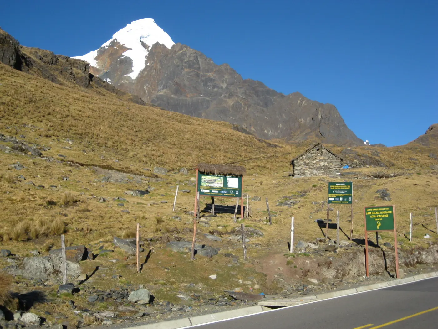
Crossing Abra Málaga by motorcycle is the most direct way to feel, in a single morning, how completely Peru can change: you leave Ollantaytambo among the bare mountains of the puna and crest the pass at 4,316 meters, with snow-capped Verónica (5,682 m) in the background, then drop through clouds into the high jungle of Santa Teresa.
The upper stretch is one of the few places on Earth where Polylepis (queñual) forest still survives near its maximum altitude limit, and it's a world-reference spot for endemic bird sightings — which is why you share the road with birdwatchers as much as with motorcycle travelers.
On the other side of the pass, the route becomes the unofficial "back door" to Machu Picchu: from Santa Teresa you can reach Hidroeléctrica in another couple of hours and walk the tracks to Aguas Calientes from there — the real alternative for anyone who'd rather finish the trip on two wheels instead of the tourist train.
WARNINGS FOR THIS ROUTE
This is what you need to sort out before riding this route.
- 01Fuel range
Good as far as Ollantaytambo. Past the pass, the next reliable station is in Quillabamba — leave with a full tank.
Colca Canyon:the world's second-deepest canyon
Arequipa (Chivay–Cabanaconde–AR-106)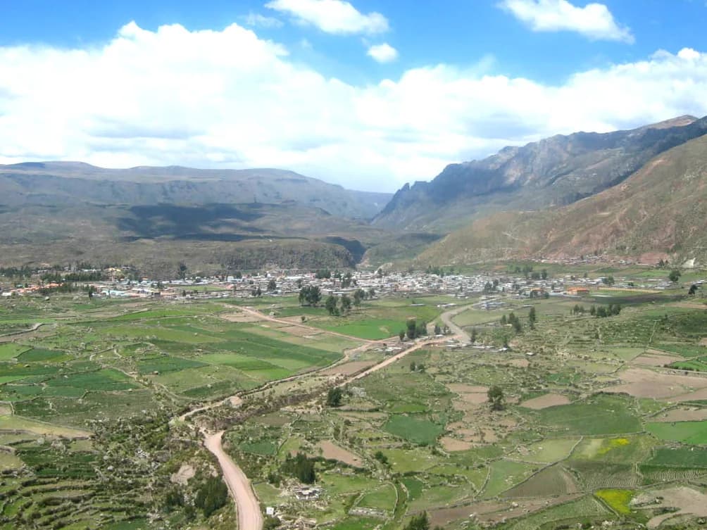
Riding Colca Canyon by motorcycle means tracing the second-deepest canyon on the planet: it reaches 4,160 meters deep near Quillo Orco, second only to Tibet's Yarlung Tsangpo (5,590 m).
The mandatory stop is Cruz del Cóndor, the lookout where the Andean condor — the world's largest flying bird — rides the morning thermals almost level with the road. There was no real road to Chivay until the 1940s, when one was opened to serve the area's silver and copper mines.
Whoever continues past Cabanaconde enters the AR-106, a 100% dirt stretch that drops from nearly 4,000 to 1,500 meters through an almost lunar landscape, past pre-Inca farming terraces of the Collagua and Cabana cultures still worked today, connecting on to the Valley of the Volcanoes near Andagua.
WARNINGS FOR THIS ROUTE
This is what you need to sort out before riding this route.
- 01Fuel range
Good in Chivay. Past Cabanaconde there are no stations — the Huambo-Ayo stretch runs on whatever's in your tank.
- 02Unguarded exposed curves on the AR-106
The dirt stretch toward Ayo has loose-sand curves right at the drop-off, with no guardrail of any kind — slow down before every blind curve.
Cañón del Pato:35 tunnels between the Cordillera Blanca and Negra
Áncash (Caraz–Huallanca)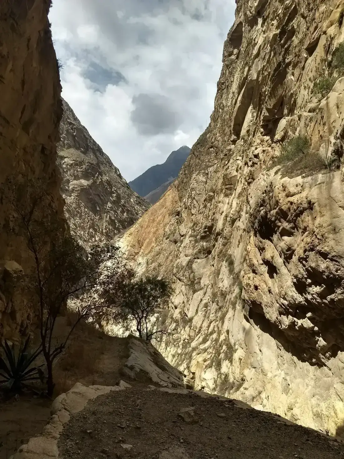
Riding Cañón del Pato by motorcycle means squeezing into the crack where the Cordillera Blanca and Cordillera Negra almost touch, leaving barely enough room for the Río Santa — and the road — to pass between nearly vertical rock walls.
Between 1917 and 1940 a railway was built there to move Áncash's mining and farm output down to the coast; the era's corruption left only the Chimbote-Huallanca stretch finished, and the 1970 earthquake — the same one that buried Yungay — finished it off. Today's road was laid literally over those abandoned rails.
Of the original tunnels hand-carved into solid rock for that railway line, 35 are packed one after another in barely 12.5 km — the reason this stretch is known today as the "canyon of the 35 tunnels." They're single-lane: you have to look before entering each mouth, because meeting a truck head-on inside a tunnel has no elegant solution.
WARNINGS FOR THIS ROUTE
This is what you need to sort out before riding this route.
- 01Fuel range
Fair. Fill up in Caraz — there are no gas stations inside the canyon.
- 02Single-lane tunnels
It's not advisable to ride the canyon at night — visibility inside the tunnels drops sharply and meeting oncoming traffic is more dangerous.
Punta Olímpica:the highest vehicular tunnel in the Americas
Áncash (Carhuaz–Chacas, Cordillera Blanca)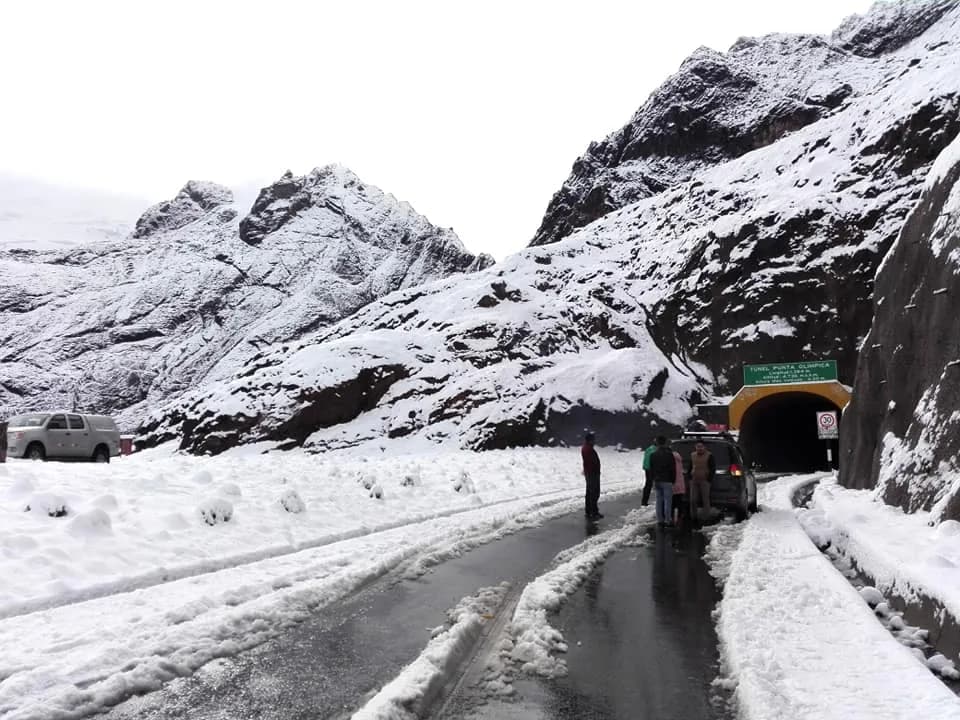
Climbing to Punta Olímpica by motorcycle means reaching one of the highest points in all of Peru you can drive or ride to: the tunnel bores through the Cordillera Blanca at 4,736 meters above sea level, inside Huascarán National Park, a UNESCO Biosphere Reserve.
It was built in under a year — drilling started May 15, 2012 and finished February 24, 2013 — and opened in August of that same year. At 1,384 meters long, it's Peru's longest vehicular tunnel and the highest in the Americas.
What makes the route unique is the contrast: you climb past snow peaks like Chopicalqui on the Callejón de Huaylas side, cross the tunnel, and descend the other side into the Callejón de Conchucos, a far less-visited valley, down to Chacas, a colonial town famous for its woodcarving school founded by an Italian missionary.
WARNINGS FOR THIS ROUTE
This is what you need to sort out before riding this route.
- 01Fuel range
Good in Carhuaz. Between Carhuaz and Chacas (100 km) there are no stations — leave with a full tank.
- 02Snow and ice at the tunnel mouth
At nearly 4,800 meters the temperature drops well below freezing, and in the rainy season snow can cover the road — bring real cold-weather layers, not just your riding jacket.
Ticlio:the Carretera Central to the roof of the Andes
Lima–Junín (Abra de Antícona, PE-22)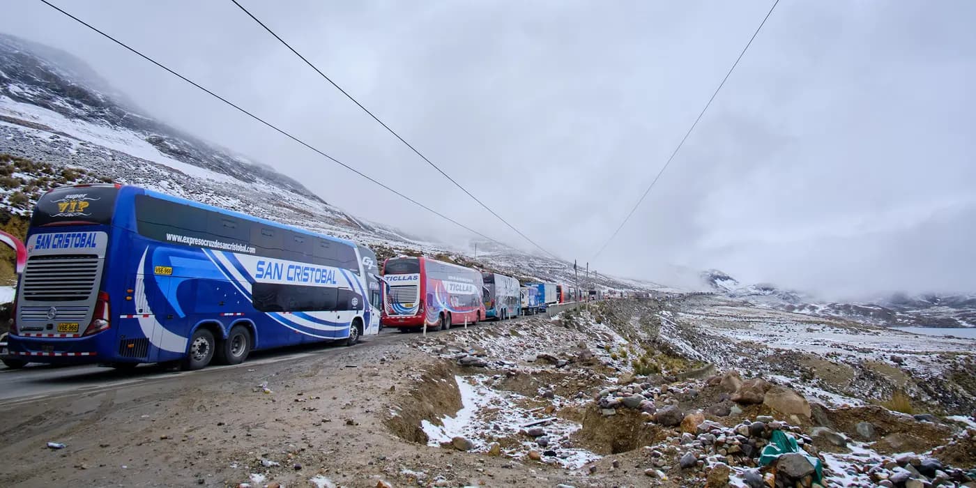
Climbing the Carretera Central to Ticlio by motorcycle means making, in under 200 km, one of the fastest sea-to-altitude climbs anywhere in the world: you leave Lima on the Pacific shore and crest the Abra de Antícona, popularly known as Ticlio, at 4,818 meters above sea level.
The road took ten years to build and was inaugurated on July 1, 1935 by President Óscar R. Benavides — for decades it was the country's most important transverse axis, the route connecting Lima with the La Oroya mines and the central highlands.
Right alongside it runs the Ferrocarril Central Andino, which for a long time held one of the highest-altitude passenger railway stations in the world. Today the route is flagged as one of Peru's most dangerous roads for its sharp curves, narrow roadway and frequent landslides — it's not a technical off-road ride, but it demands respect for the heavy mining-truck traffic you share it with.
WARNINGS FOR THIS ROUTE
This is what you need to sort out before riding this route.
- 01Fuel range
Excellent — stations in Chosica, Matucana and La Oroya, though the stretch between San Mateo and Ticlio runs long without service.
- 02One of Peru's most dangerous roads
Sharp curves, a narrow roadway and frequent landslides, made worse by constant mining-truck traffic — flagged this way by local road-tourism sources.
Interoceánica Sur:from the Cusco Andes to the Madre de Dios jungle
Cusco–Madre de Dios (Cusco–Puerto Maldonado)Riding down the Interoceánica Sur by motorcycle means crossing, in a single long day, two worlds that in most countries don't even share a border: you leave Cusco among Andean peaks near 4,000 meters and end up in Puerto Maldonado, at just 250 meters, already inside the Amazon.
The highway was completed in 2011 after an investment that topped $2.8 billion, built to connect the Pacific with the Atlantic through Brazil. The project was marked by corruption: Odebrecht admitted to U.S. prosecutors that it paid $20 million in bribes to win the contract, a case that ended up implicating former president Alejandro Toledo.
The same road that made tourism easier also accelerated informal gold mining and deforestation in Madre de Dios — towns like La Pampa, right on the highway, sprang up overnight around that gold rush. It's a route of real contrast, not just scenery.
WARNINGS FOR THIS ROUTE
This is what you need to sort out before riding this route.
- 01Fuel range
Fair. There are gas stations in Urcos, Quincemil, Mazuko and Puerto Maldonado, but the stretches between towns are long and lightly traveled.
- 02Stretches with informal mining
Near La Pampa and other mining camps along the highway there's little oversight and reports of lawlessness — avoid riding through those stretches at night and don't camp near the camps.
Abra La Raya:the Route of the Sun to Lake Titicaca
Cusco–Puno (PE-3S, Sicuani–Ayaviri)Crossing Abra La Raya by motorcycle means passing over southern Peru's most important watershed: at 4,335 meters, whatever falls north of the pass feeds the Vilcanota river toward the Amazon and the Atlantic, and whatever falls south drains straight into Lake Titicaca's closed basin.
During Inca times, this same pass marked the boundary between Chinchaysuyo (the Cusco region) and Qollasuyo (the altiplano), and it was part of the Qhapaq Ñan road network used for trade and for moving Inca armies.
The La Raya train station, right beside the highway, was for decades one of the highest-altitude stations in the world with regular passenger service — today the Andean Explorer tourist train runs it. It's also the safest, most direct paved route on this list: a good recovery day on the bike between more demanding stretches like Colca or the Interoceánica.
WARNINGS FOR THIS ROUTE
This is what you need to sort out before riding this route.
- 01Fuel range
Good — it's the national highway connecting Cusco with Puno, with stations in Sicuani, Ayaviri and Juliaca.
Nor Yauyos-Cochas:the turquoise lagoons a day's ride from Lima
Lima–Junín (Cañete valley, Yauyos)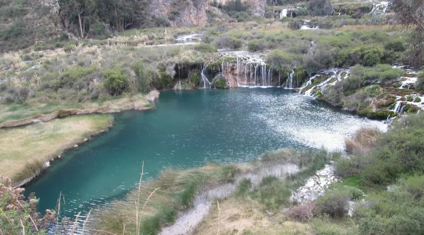
Climbing up to Nor Yauyos-Cochas by motorcycle is the closest high-altitude escape a Lima-based rider has: in a single day you reach lagoons of an almost unreal turquoise, fed by the same high-altitude wetlands that supply the capital's drinking water.
Declared Peru's first Landscape Reserve in 2001, the area spans 2,500 to 5,700 masl and packs, along just 20 km of the Cañete river, stepped waterfalls like Cabracancha and mirror-still lagoons like Papacocha, in the town of Vilca.
Unlike Cusco or Arequipa, this doesn't demand a multi-day trip: it's the perfect route for anyone who wants mixed terrain, altitude and postcard scenery without committing a full week — and along the way you cross pre-Inca farming terraces that local villages still work today.
WARNINGS FOR THIS ROUTE
This is what you need to sort out before riding this route.
- 01Fuel range
Fair. Last reliable station in Cañete or Yauyos — there are no gas stations inside the reserve.
Huacachina Dunes:Ica's desert oasis
Ica (Huacachina oasis)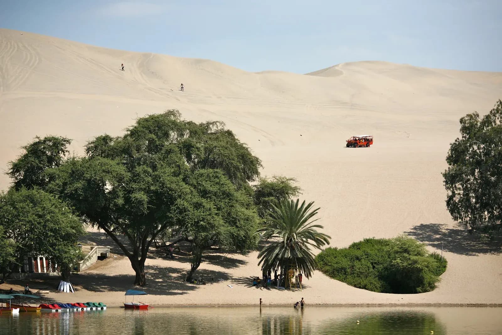
Riding the Huacachina dunes by motorcycle is the most different route on this entire Top 10: no pavement, no gravel, no altitude — just sand, on some of South America's tallest dunes, over 100 meters high, ringing a natural lagoon in the middle of the desert.
The oasis grew up around a small lagoon that local legend attributes to a mermaid turned to stone while fleeing a hunter — the same image Peru chose for its 1991 50-sol banknote, proof of how much this place weighs in the national imagination.
Unlike the Andean routes on this list, the difficulty here isn't altitude or cold but loose sand: without constant traction the bike buries itself in seconds, and anyone unfamiliar with the dunes gets disoriented fast — which is why nearly every local motocross and enduro operator insists on always riding out with a guide.
WARNINGS FOR THIS ROUTE
This is what you need to sort out before riding this route.
- 01Fuel range
Good in the city of Ica, 5 km away. There's no service of any kind inside the dunes.
- 02Getting disoriented in the dunes
Without fixed landmarks it's easy to lose your bearings between dunes — local motocross operators themselves recommend never going in without a guide, especially close to sunset.
Chachapoyas and Kuelap:the lost fortress in the cloud forest
Amazonas (Chachapoyas–Tingo–Kuelap–Leymebamba)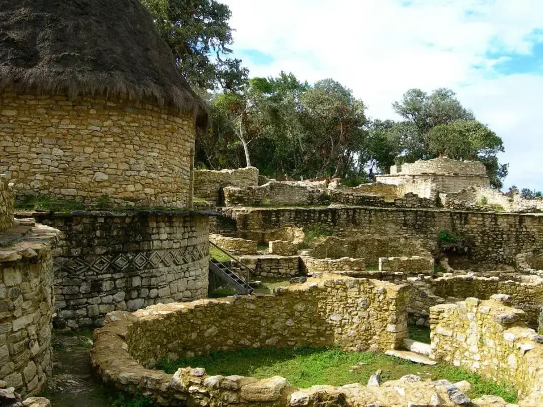
Reaching Kuelap by motorcycle means riding into the region least traveled by motorcyclists in all of Peru: the Amazonas "ceja de selva," halfway between the Andes and the Amazon, where fog blankets cloud forest and sheer drops alike.
The Kuelap fortress was built by the Chachapoyas culture — the "warriors of the clouds" — between the 9th and 16th centuries AD, with stone walls up to 20 meters tall that once housed thousands of people; many archaeologists call it the "Machu Picchu of the north," though it draws a tiny fraction of the visitors. Since 2017 a cable car has shortened the final climb.
The same circuit passes near the Gocta waterfall, with a 771-meter drop — one of the tallest in the world — that stayed off international tourist maps until the early 2000s. It's the route that rewards whoever is looking for the country's least-photographed corner, not its most Instagrammable one.
WARNINGS FOR THIS ROUTE
This is what you need to sort out before riding this route.
- 01Fuel range
Fair. Fill up in Chachapoyas — supply in the villages along the circuit is limited and irregular.
- 02Muddy dirt road in the rainy season
Between December and March the dirt stretch to Kuelap turns slippery with sections of deep mud — skip the circuit outside the dry season if you don't have experience riding wet off-road.
NEIGHBORING COUNTRIES
Crossing the border next? Click a country to see its 10 best motorcycle routes.

FREQUENTLY ASKED QUESTIONS
01What documents do I need to enter Peru by motorcycle?
+
What documents do I need to enter Peru by motorcycle?
A valid passport, driving license, the motorcycle's title (or notarized power of attorney if you're not the owner), SOAT insurance, and the CIT (Temporary Import Certificate) that Customs issues right at the border.
02Is SOAT insurance mandatory for a foreign-plated motorcycle in Peru?
+
Is SOAT insurance mandatory for a foreign-plated motorcycle in Peru?
Yes. SOAT covers traffic accidents inside Peru and is mandatory for any vehicle circulating in the country, regardless of where it's plated. Buy it at the border crossing or from a local insurer before you cross.
03How long can I stay in Peru with my foreign motorcycle?
+
How long can I stay in Peru with my foreign motorcycle?
The motorcycle's CIT is granted for the same length as your tourist visa, up to a maximum of 90 days. If you need more time, you have to request an extension before it expires.
04Is it safe to ride through Lima on a motorcycle?
+
Is it safe to ride through Lima on a motorcycle?
Yes, as long as you stick to the main avenues and avoid districts like San Juan de Lurigancho or Callao at night. Aggressive traffic is more of an issue for someone just passing through than crime itself.
05What's the best time of year to cross the Peruvian Andes by motorcycle?
+
What's the best time of year to cross the Peruvian Andes by motorcycle?
April to October, the dry season. Between December and March rainfall increases, along with the risk of huaicos (landslides) on mountain roads like the route to Abra Málaga.
06Is there gas available along the whole route through the jungle and high mountain passes?
+
Is there gas available along the whole route through the jungle and high mountain passes?
Not evenly. The Coast and the touristic Sierra corridor are well covered, but in the jungle and on secondary highland roads stations are spaced far apart — fill up in every sizeable town.
07Which crossing is best for riding from Peru into Bolivia?
+
Which crossing is best for riding from Peru into Bolivia?
Desaguadero is the most-used crossing, but the Puno-Juliaca area has a history of road blockades from protests — check the road status on iOverlander before you plan the crossing.
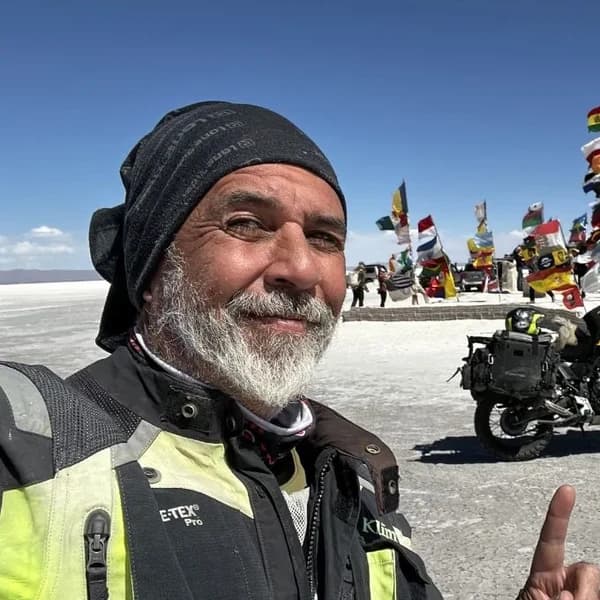
Gustavo Correa
Moto traveler, author and motorcycle travel consultant. 110,000+ km across 4 continents with Gloria, my motorcycle. Everything you read here has been tested on the road, not in an office.
Read my story →Last verified: 2026-08-29
Sources consulted (19)+
- sunat.gob.pe
- bienvenidoalperu.sunat.gob.pe
- consulado.pe
- interseguro.pe
- madornomad.com
- horizonsunlimited.com
- horizonsunlimited.com
- ioverlander.com
- ioverlander.com
- twotwolife.wordpress.com
- fpp.org.pe
- theonlyperuguide.com
- osac.gov
- en.wikipedia.org
- libero.pe
- es.wikipedia.org
- mochileandoporelmundo.com
- petroperu.com.pe
- commons.wikimedia.org
A GIFT FOR BEING HERETHE ADVENTURE OF LIVING FREE
Do fear or doubt paralyze you before starting any project? You're not alone — every one of us has been there.
As a thank-you for visiting my site, I'm giving you my book "The Adventure of Living Free". A manual built to bring some light through the shadows and show you the philosophy that has let me ride the world for years.
* PDF STRAIGHT TO YOUR INBOX. NO SPAM.